
SUNDAY WEATHER: Warnings for disruptive rain, damaging wind & waves, and snow possible as cold front arrives
By Staff WriterPublished: 27 June 2026
This forecast is for: Sun 28 June 2026
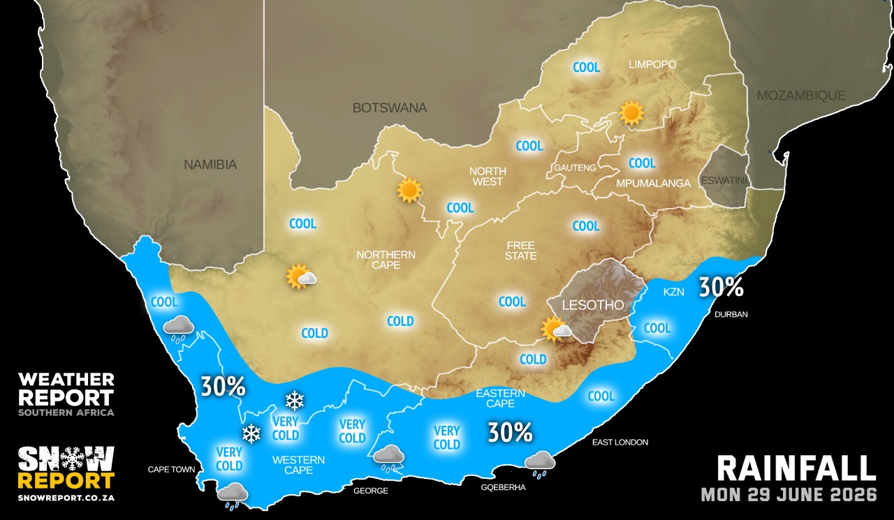
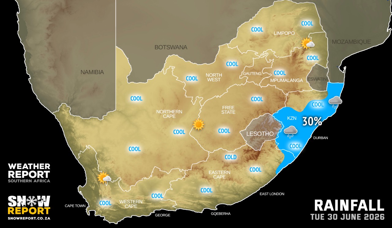
The maps cover: Sun 28 Jun – Tue 30 Jun
| SHARE TO |
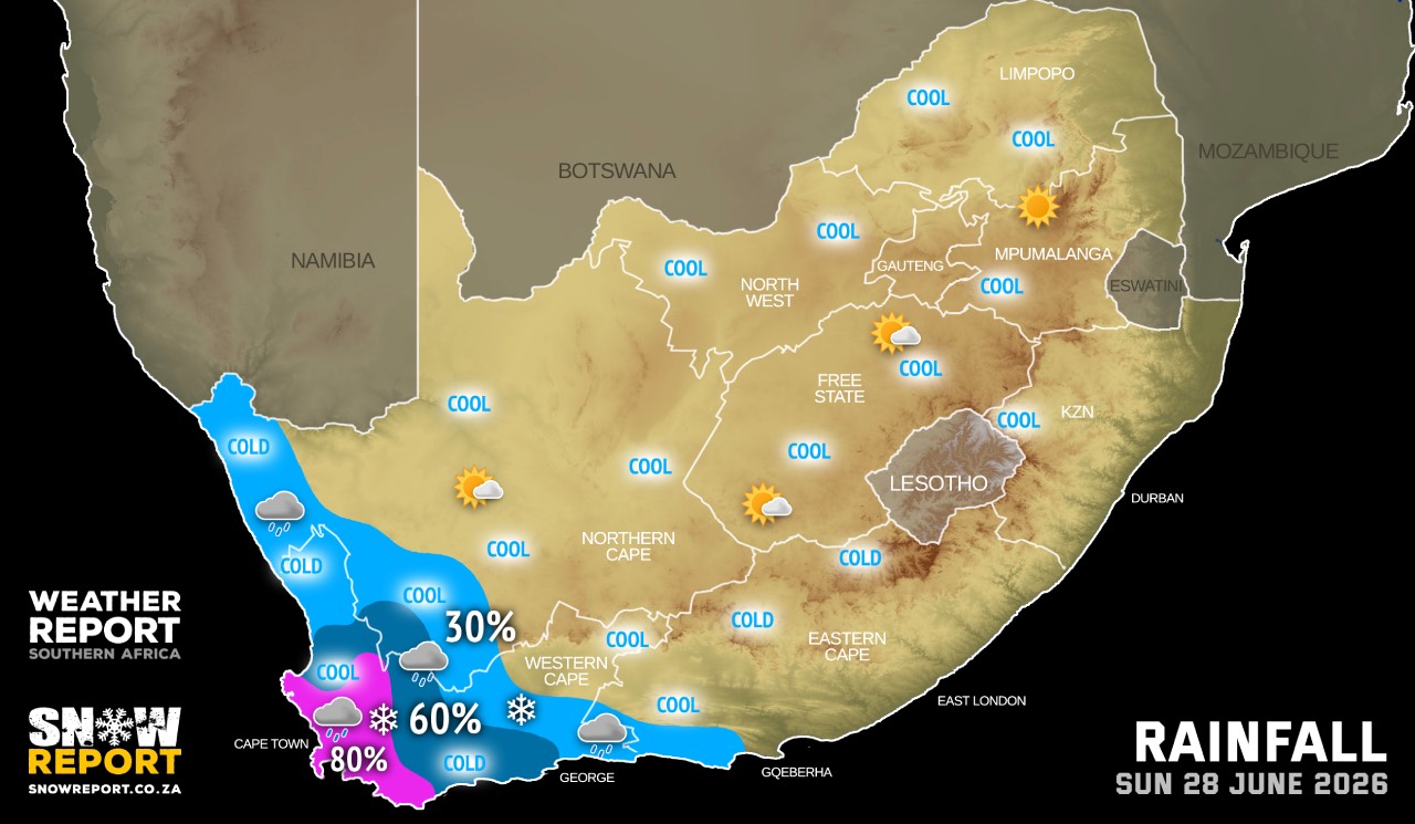
A well developed cold front is expected to affect the Western Cape and Northern Cape on Sunday and Monday. This system is expected to cause a significant drop in daytime temperatures, with maximum temperatures in the 8-10°C range in places over the southern parts of the Namakwa District in the Northern Cape as well as over the Cape Winelands district in the Western Cape from Sunday, spreading over the Central and Little Karoo (Western Cape) on Monday.
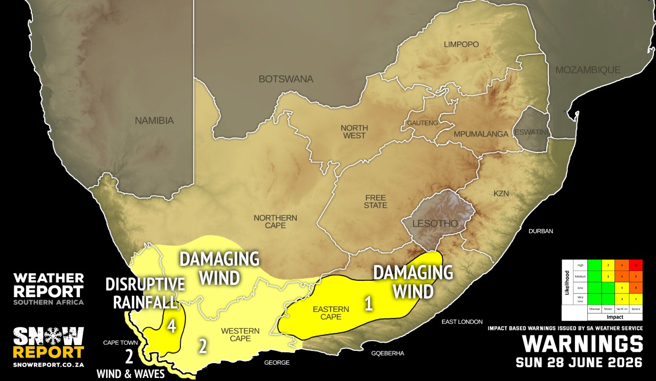
Warnings from the SA Weather Service:
A. level 4 warning disruptive rainfall leading to localised flooding of susceptible formal/informal settlements or roads, low lying areas and bridges, is expected over the City of Cape Town and the Cape Winelands districts in the Western Cape.
B. level 2 warning for damaging winds resulting in localised problems for high-sided vehicles on prone route is expected over the southern parts of Namakwa in the Northern Cape, as well as over the Western Cape.
C. level 2 warning for damaging wind and waves leading to difficulty in navigation at sea, are expected between Cape Columbine and Cape Agulhas, spreading to Plettenberg Bay on Sunday night.
D. level 1 warning for damaging winds over parts of the Eastern Cape.
SEE ALSO: Snow possible in three South African provinces from Sunday.
Regional forecasts from the SA Weather Service:
GAUTENG
Fine and cool but cold in places in the south.
MPUMALANGA
Fine and cool to cold but warm in places in the Lowveld where it will be cloudy in the morning.
LIMPOPO
Fine and cool but warm in places in the Lowveld.
NORTH WEST
Partly cloudy and cool to cold, becoming fine.
THE FREE STATE
Morning fog in places in the east, otherwise partly cloudy and cool to cold becoming fine in the north.
THE NORTHERN CAPE
Very cold and windy in places in the south-west, otherwise partly cloudy cool to cold but cloudy with isolated showers and rain in the extreme west and south-western parts. The wind along the coast will be moderate to fresh northerly to north-westerly.
THE WESTERN CAPE
Partly cloudy and cool in the north-east, otherwise cloudy, windy and cold with isolated to scattered showers and rain but widespread in the south-west where thundershowers are possible. The wind along the coast will be moderate to fresh northerly to north-westerly, but strong to near gale force along the southwest coast in the morning. It will become fresh to strong westerly to south-westerly during the afternoon.
THE WESTERN HALF OF THE EASTERN CAPE
Partly cloudy and cool but warm in the south, becoming cloudy with isolated showers and rain along the coast west of Cape St Francis. The wind along the coast will be moderate to fresh northwesterly, becoming south-westerly in the evening.
THE EASTERN HALF OF THE EASTERN CAPE
Fine and warm becoming partly cloudy in the north where it will be cool. The wind along the coast will be light to moderate northwesterly.
KWAZULU-NATAL
Fine and cool to warm. The wind along the coast will be moderate to fresh northerly to north-westerly, becoming north-easterly from late morning.
Travellers forecasts from the SA Weather Service:
PRETORIA
Fine.
Minimum/Maximum: 07/19°C
JOHANNESBURG
Fine.
Minimum/Maximum: 05/17°C
VEREENIGING
Fine.
Minimum/Maximum: 04/18°C
MBOMBELA
Fine.
Minimum/Maximum: 09/24°C
POLOKWANE
Fine.
Minimum/Maximum: 07/20°C
MAHIKENG
Partly cloudy becoming fine.
Minimum/Maximum: 09/22°C
VRYBURG
Partly cloudy becoming fine.
Minimum/Maximum: 08/21°C
BLOEMFONTEIN
Partly cloudy becoming fine.
Minimum/Maximum: 08/19°C
KIMBERLEY
Partly cloudy becoming fine.
Minimum/Maximum: 10/23°C
UPINGTON
Partly cloudy.
Minimum/Maximum: 12/25°C
CAPE TOWN
Cloudy with widespread showers and thundershowers.
Wind: Strong north-westerly, moderating from the afternoon, becoming light south-westerly from late evening.
Minimum/Maximum: 13/15°C
GEORGE
Partly cloudy with isolated showers and rain from the afternoon.
Wind: Light to moderate west to north-westerly, but fresh to strong from late morning until early evening.
Minimum/Maximum: 15/23°C
GQEBERHA
Partly cloudy becoming cloudy in the afternoon.
Wind: Moderate to fresh north-westerly, becoming south-westerly in the evening.
Minimum/Maximum: 15/25°C
KuGOMPO CITY
Fine becoming partly cloudy.
Wind: Light to moderate north-westerly.
Minimum/Maximum: 19/27°C
DURBAN
Fine.
Wind: Light north-westerly in the morning, otherwise moderate to fresh northerly to north-easterly.
Minimum/Maximum: 14/28°C
RICHARDS BAY
Fine.
Wind: Moderate to fresh northerly to north-easterly.
Minimum/Maximum: 15/28°C
PIETERMARITZBURG
Fine.
Minimum/Maximum: 06/24°C
This forecast is usually updated a few times per day.
| SHARE TO |
Please be sure to send photos and videos to us via whatsapp and also tell us where and when they were taken.
Follow our channels