
Widespread snow this week with disruptive snow in places21 July 2019 - 21:00PMBy Rob Ansell and Richard Le Sueur
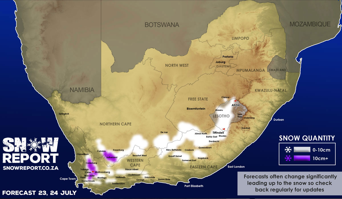
There is a high chance of fairly widespread snow falling in South Africa and Lesotho starting on Tuesday the 23rd of July, with up to 20cm possible in places indicated by purple on the map. At this point an incoming front looks likely to deposit snow onto the high peaks of almost all of the Western Cape mountain ranges during Tuesday, the southern parts of the Northern Cape, high ground in the Eastern Cape, parts of the Free State, much of Lesotho and parts of the Free State. Snow is expected to start falling in the early hours of Tuesday morning in the Western Cape and as the front sweeps across the country more snow will fall through Tuesday and into Wednesday. The South African Weather Service have confirmed that the snowfall may be disruptive in parts of the Western Cape and Northern Cape. At this point lower level snow that is accessible by vehicle is indicated in many areas of the country as per the map, although it is important to note that the snow regions shown on the map are a general indicator of snow at various altitudes. A more detailed forecast with more specific regional information will be posted by SnowReportSA before the event. Should you be traveling through any snow zones please be sure to take photos and/or videos and send them to us ASAP (whatsapp 072 390-8021). * Please note that SnowReportSA has new terms & conditions for the use of our forecasts, maps, images and video by other media platforms. See the link below for details.
View our snow webcams Accommodation in snow regions |