
More widespread and low-level snow from Monday16 August 2020By Staff Writer
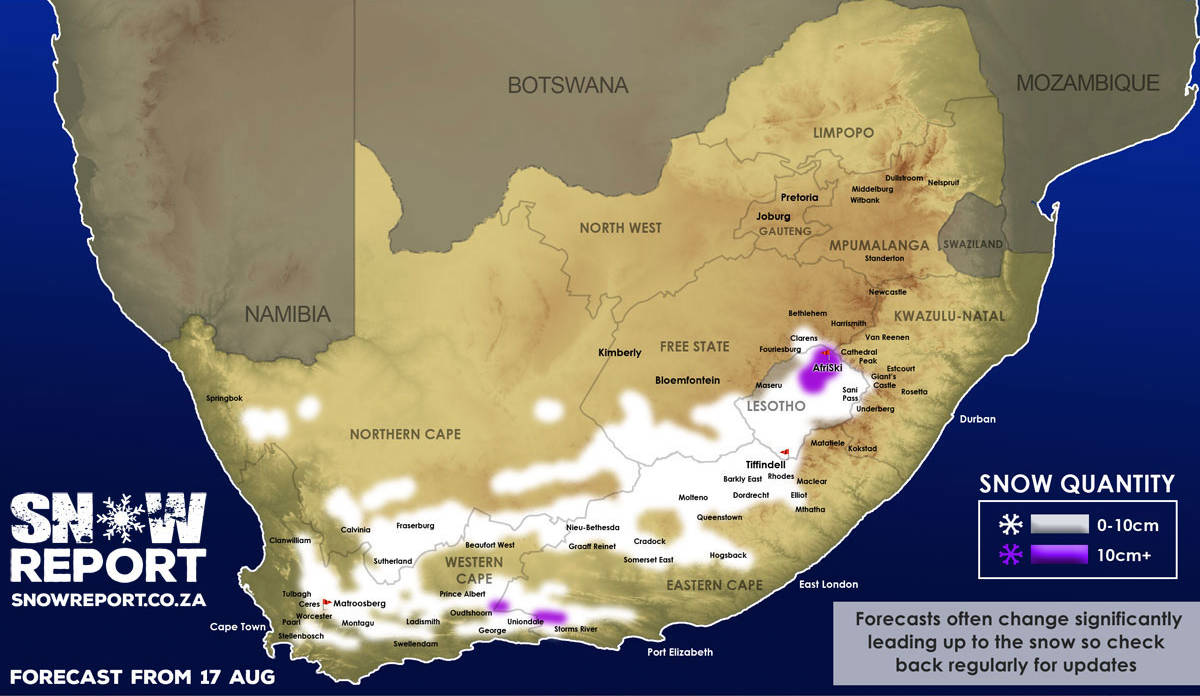
Low-level snow is possible in parts of the Western Cape, Eastern Cape, Northern Cape and Free State and the freezing level may drop as low as 1000m. The South African Weather Service has warned that disruptive snowfalls expected over the high lying grounds of Cape Winelands, central Karoo and Garden Route Districts as well as Karoo Hoogland in the Northern Cape. Up to 13cm is indicated for higher elevations as marked on the map. We have a FREE channel on Telegram Messenger, so please download it if you want to be the first to know when snow is forecast or photos are posted. Click to join our Telegram Channel We would like to remind snow lovers that those traveling to see snow should do so safely, while noting travel regulations. Please be sure to send photos and videos to us via whatsapp to 081 251 8029. Please note on snow days we do not have the capacity to answer questions so please watch our facebook page to see what is happening. Don't miss the opportunity reach a large audience by advertising your brand or service with SA's biggest winter-focused media channel. * Please note SnowReportSA's updated terms & conditions for the use of our forecasts, maps, images and video by other media and channels. Sharing, where permitted by us, must be done using standard sharing buttons (it is NEVER acceptable to download and repost our images). See the media guidelines link below for details.
|