
 Thunderstorms, big hail and some flooding over the last few days10 October 2023 [updated 15 October]By Staff Writer
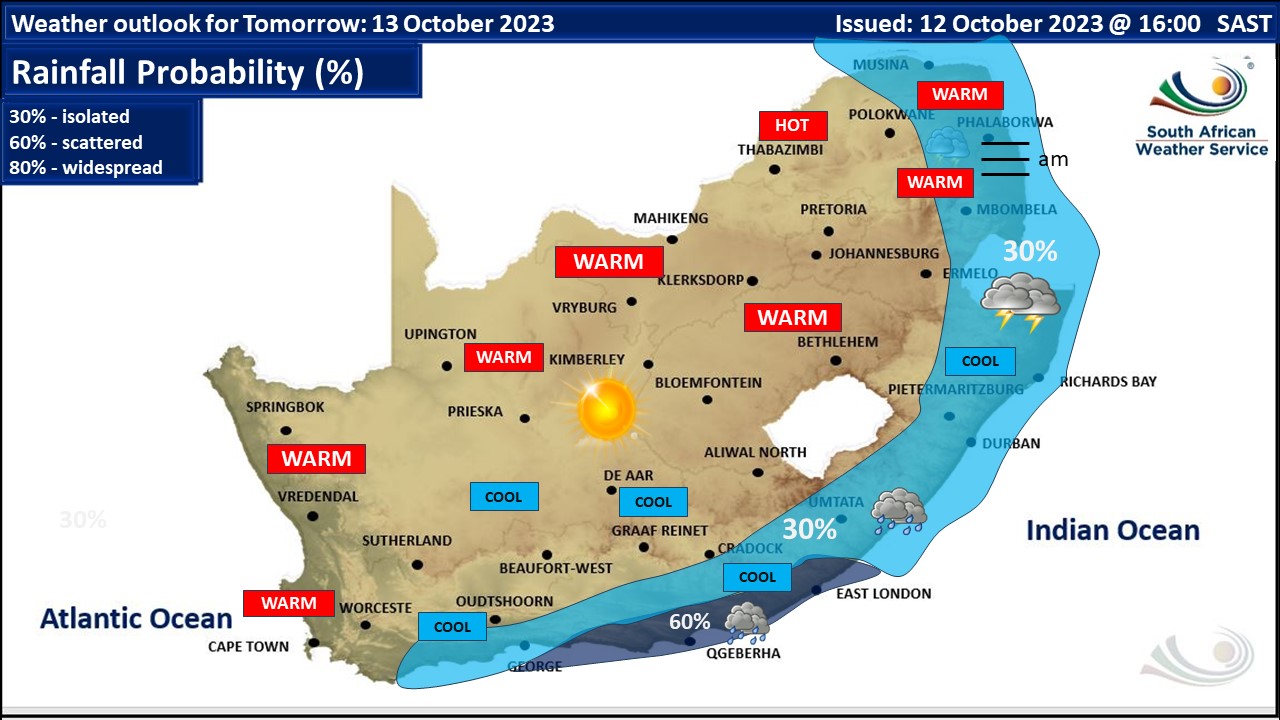
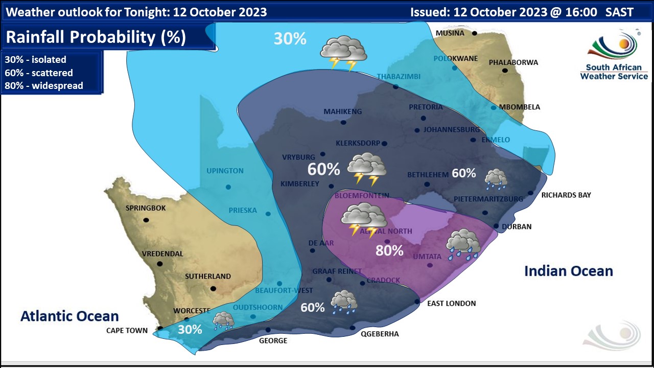
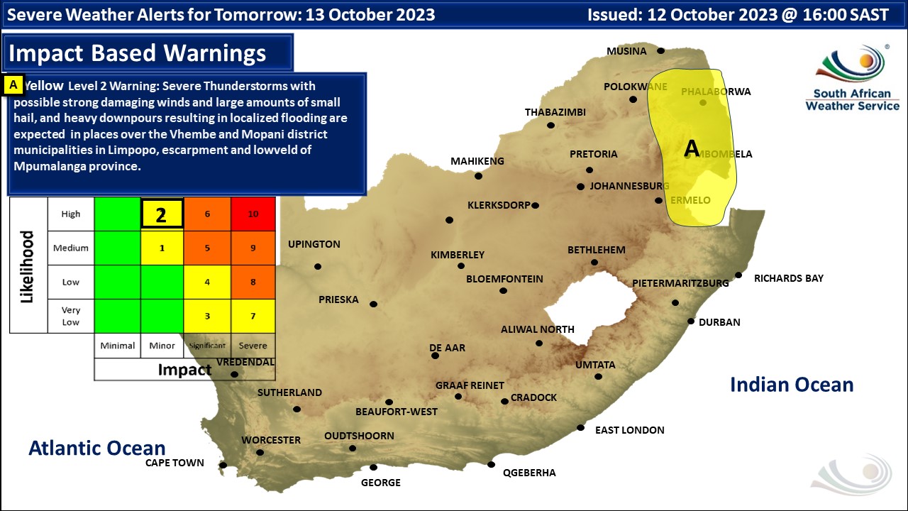
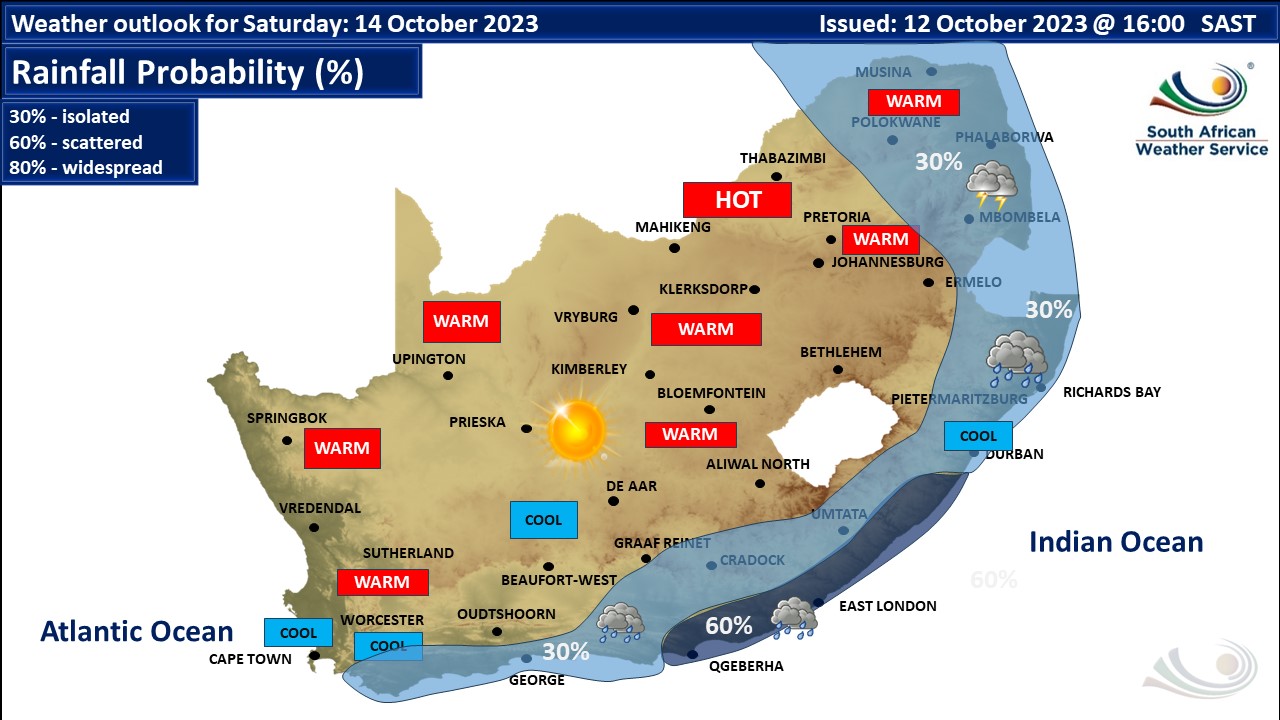
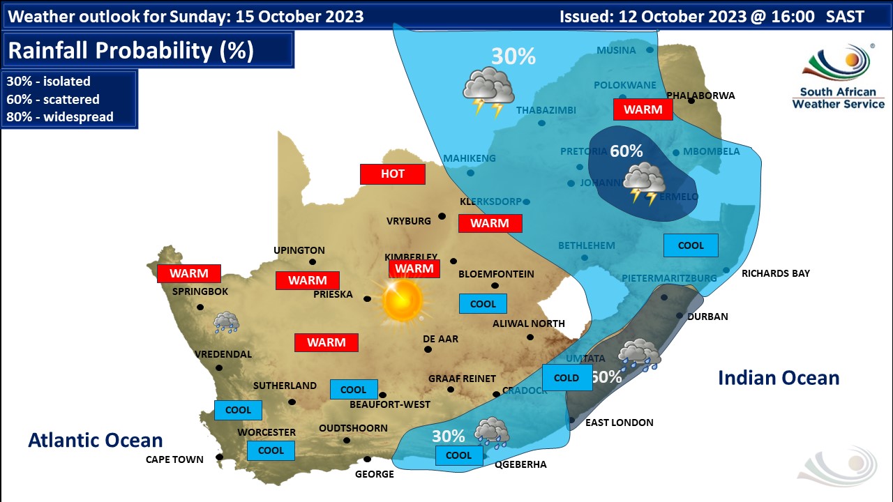
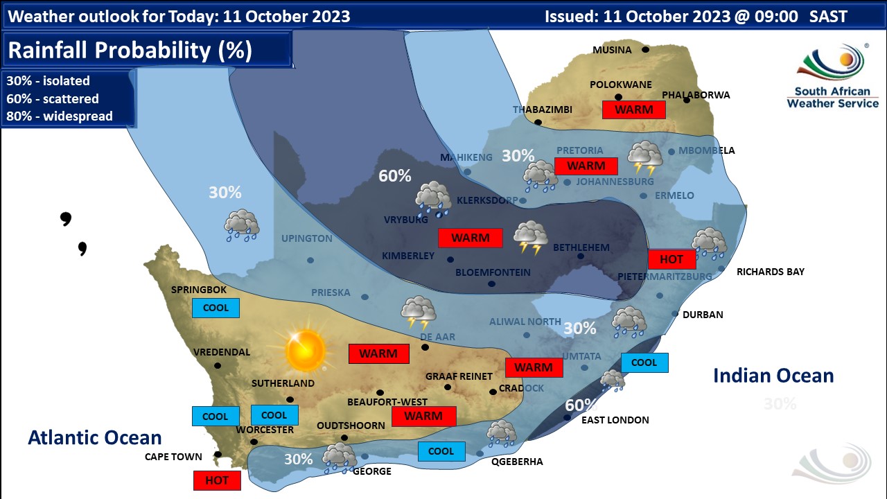
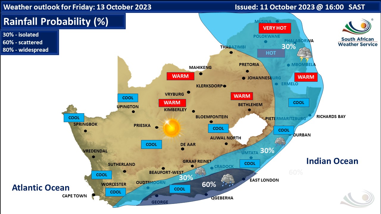
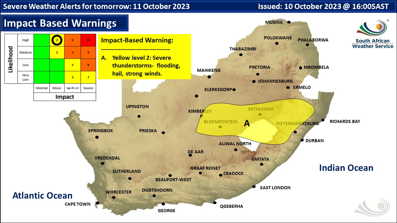
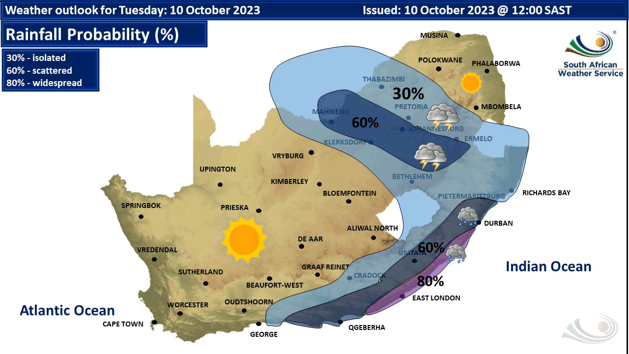
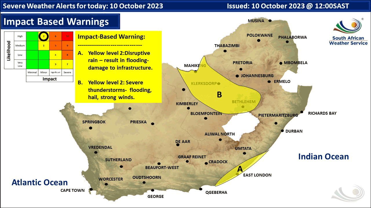
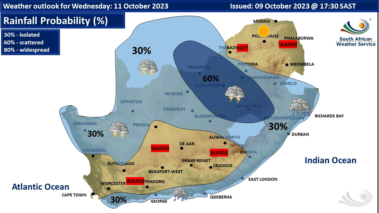
A severe weather alert has been issued by the South African Weather Service (SAWS). The following warnings and outlooks were issued by SAWS: Yellow level 2 warning a high likelihood of severe thunderstorms in North West and the eastern Free State for Tuesday 10 October, potentially resulting in a minor impact from flooding, hail and strong winds. Yellow level 2 warning for a high likelihood of disruptive rain in parts of the Eastern Cape on Tuesday, potentially resulting in a minor impact from flooding and possible damage to infrastructure. The weather outlook for Wednesday 11 October includes scattered to isolated showers and thundershowers, except over the north eastern parts as well as the south western areas, as per the map from SAWS above. Yellow level 2 warning for a high likelihood of severe thunderstorms in parts of the central Free State as well as the western parts of KZN on Wednesday, potentially resulting in a minor impact from flooding, hail and strong winds. The weather outlook for Thursday 12 October sees a steep upper trough situated south-west of the country, sending perturbation over the central parts of the country. This will result in isolated to scattered showers and thundershowers over most parts of the country with drizzle along the west coast but wide spread showers over the south-eastern interior, as per the map from SAWS below. Yellow level 2/4 warning for a high likelihood of severe thunderstorms over the Northern Cape, Free State, North-west, eastern parts of the Eastern Cape and KwaZulu-Natal on Thursday, potentially resulting in a severe weather impacts from heavy downpours, flooding, hail and damaging winds. See the map below for detailed region-specific impacts. The weather outlook for Friday 13 October includes a steep upper trough slipping south with perturbations in the eastern interior. This will result in isolated to scattered showers and thundershowers over the extreme eastern and southern parts of the country. Yellow level 2 warning for a high likelihood of severe thunderstorms expected along the escarpment and lowveld of both Limpopo and Mpumalanga on Friday, potentially resulting in a minor impact from damaging winds, small and large hail and heavy downpours resulting in localised flooding, as per the maps below. The weather outlook for Saturday 14 October includes scattered showers and rain along the south-east coast and adjacent interior but isolated showers and thundershowers along the south coast, south-eastern interior and extreme eastern parts. Otherwise fine and cool to warm conditions can be expected over the rest of the country, as per the map from SAWS below. The weather outlook for Sunday 15 October includes isolated to scattered showers and thundershowers over the eastern parts, along the south-east coast and adjacent interior. Otherwise fine conditions are expected over the western parts of the country, as per the map from SAWS below. Maps with the region-specific alerts and warnings can be found below. This forecast changes regularly and updates will be issued periodically. Please be sure to send photos and videos to us via whatsapp 081 251 8029 and also tell us where and when they were taken. Follow our channels
* Please note SnowReportSA's updated terms & conditions for the use of our forecasts, our maps, as well as images and video sent to us. Sharing, where permitted by us, must be done using standard sharing buttons (it is NEVER acceptable to download or screen grab and repost content from our channels). Use of ANY of the content we publish by other news media channels, commercial or otherwise, requires an arrangement with us. Usage of any maps from other parties such as SAWS is as per their terms and conditions.
Issued on Thursday
       Issued on Wednesday

Issued on Tuesday
   Issued on Monday
 |