
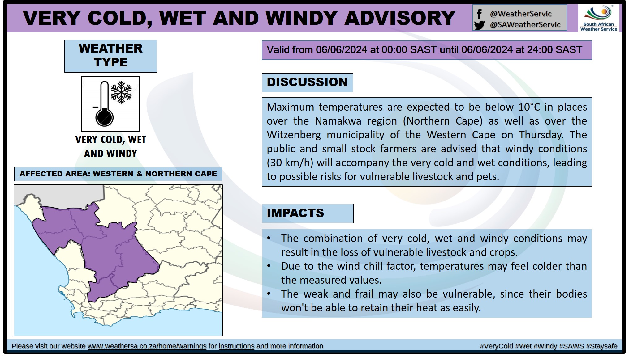
 More rain incoming and disruptive snowfall too5 June 2024 [updated 7 June]By Staff Writer
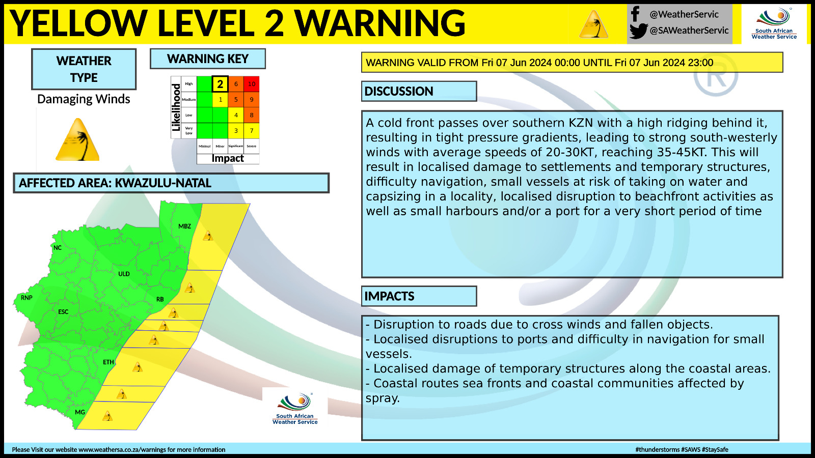
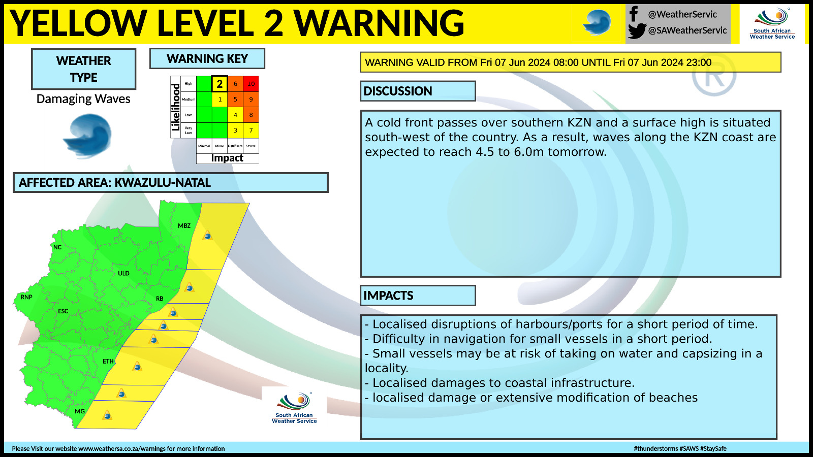
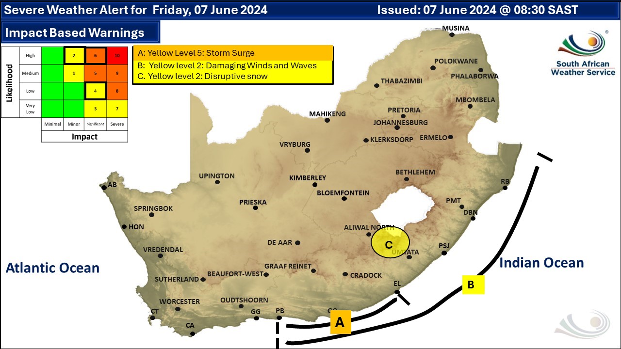
A newer weather forecast can be found here. The snowfall was looking like it would come to an end early on Wednesday, but then more snow appeared on the radar for the early hours of Friday morning and very cold conditions are expected over the interior of the Eastern Cape. The mountain passes in the region that were closed on Tuesday due to heavy snowfalls have now been reopened to traffic but a disruptive snowfall warning has been issued for Friday. We have also posted an updated snow forecast that includes Friday night here. A cold front is expected to affect the Western and Northern Cape provinces from Thursday resulting in cold, wet and windy conditions in places over the Namakwa District of the Northern Cape and western interior of the Western Cape. Very cold, wet and windy conditions are expected in places over the Namakwa in Northern Cape and the Witzenberg municipality in Western Cape on Thursday, according to the South African Weather Service (SAWS). Extremely high fire danger conditions are expected over Limpopo in Modimolle Local Municipality, the eastern parts of the Free State and North West and the southern parts of Gauteng. Temperatures will decrease further from Friday over the central, eastern and southern parts of the country while slightly increasing in the west, according to SAWS. Very cold conditions are expected in places over the eastern Highveld of Mpumalanga on Saturday. Very cold, wet and windy conditions are expected over the southern parts of both Free State and Northern Cape, as well as the Karoo Hoogland and Beaufort West municipalities in the Western Cape on Friday. Regional forecasts from SAWS for Saturday: 1. GAUTENG Fine and cool to cold with morning frost in places in the south. The expected UVB sunburn index: High. 2. MPUMALANGA Cloudy over the southern and eastern parts with isolated light showers and rain over the south-eastern Highveld, otherwise partly cloudy and cold but very cold in places over the eastern Highveld. It will be cool and windy in the Lowveld. 3. LIMPOPO Fine in the west and south in the morning, otherwise partly cloudy and cool but cold over the central parts. It will be windy in the eastern and northern parts. 4. NORTH-WEST PROVINCE Morning fog patches in the south-west, otherwise fine, windy and cold to cool. 5. FREE STATE Fine and cold with morning fog patches in the west. 6. NORTHERN CAPE Morning fog patches over the central and eastern interior, otherwise fine and cold to cool. Wind along the coast will be moderate to fresh south-easterly. 7. WESTERN CAPE Morning fog patches over the northern interior, otherwise fine and cold to cool. The wind along the coast will be light to moderate south-easterly to easterly along the south-west coast reaching fresh along the west coast, otherwise light north- easterly becoming light and variable in the afternoon. The expected UVB sunburn index: Moderate 8. WESTERN HALF OF THE EASTERN CAPE Cloudy at first with fog patches over the interior, otherwise partly cloudy and cold, becoming fine in the afternoon. The wind along the coast will be light to moderate north-easterly. 9. EASTERN HALF OF THE EASTERN CAPE Cloudy at first with isolated morning showers and rain in the east, otherwise partly cloudy and cold, but very cold in places in the north. The wind along the coast will be light to moderate north-easterly. 10. KWAZULU-NATAL Cloudy and cool to cold with isolated light showers and rain. The wind along the coast will be moderate to fresh south-westerly to southerly. The expected UVB sunburn index: Low. See the South African Weather Service maps below. This forecast changes regularly and updates will be issued periodically. Please be sure to send photos and videos to us via whatsapp and also tell us where and when they were taken. See below for a link to our whatsapp channel but since the link does not work in the instagram app you will need to send us a whatsapp message and we'll send you a link. Follow our channels
Standard users are welcome to use the standard sharing buttons on this page to share our content. It is NOT acceptable to download or screen grab for reposting. Other media and channels need to send us a request in order to embed or use of our forecasts, maps, as well as images and video from our users that we post (before doing so).
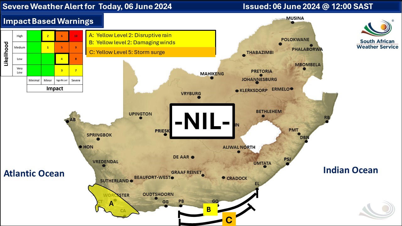
Issued on Friday
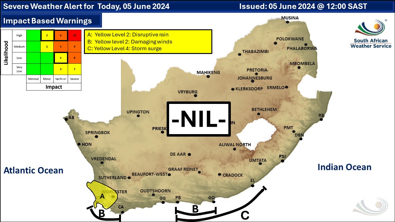
       Issued on Thursday
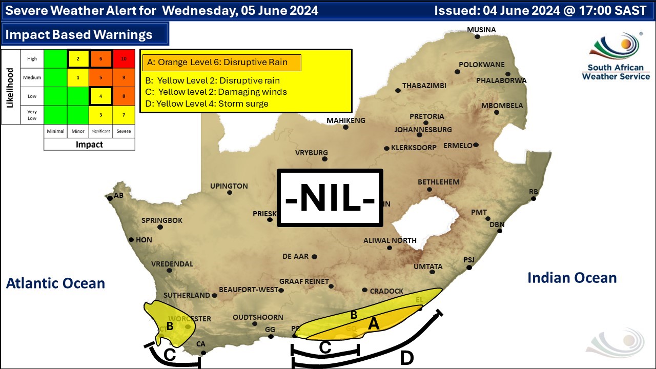
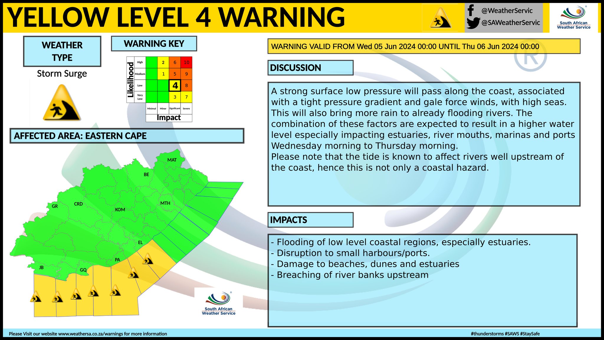
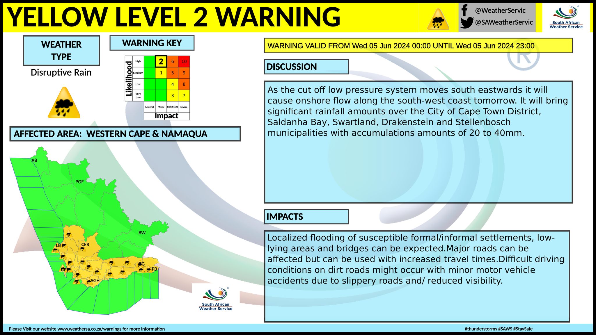
   Issued on Wednesday
 Issued on Tuesday
    |