
WEATHER OUTLOOK: Cut-off low bringing colder and windy conditions from Tuesday – more snow possible including in Namibia
By Staff WriterPublished: 15 June 2026
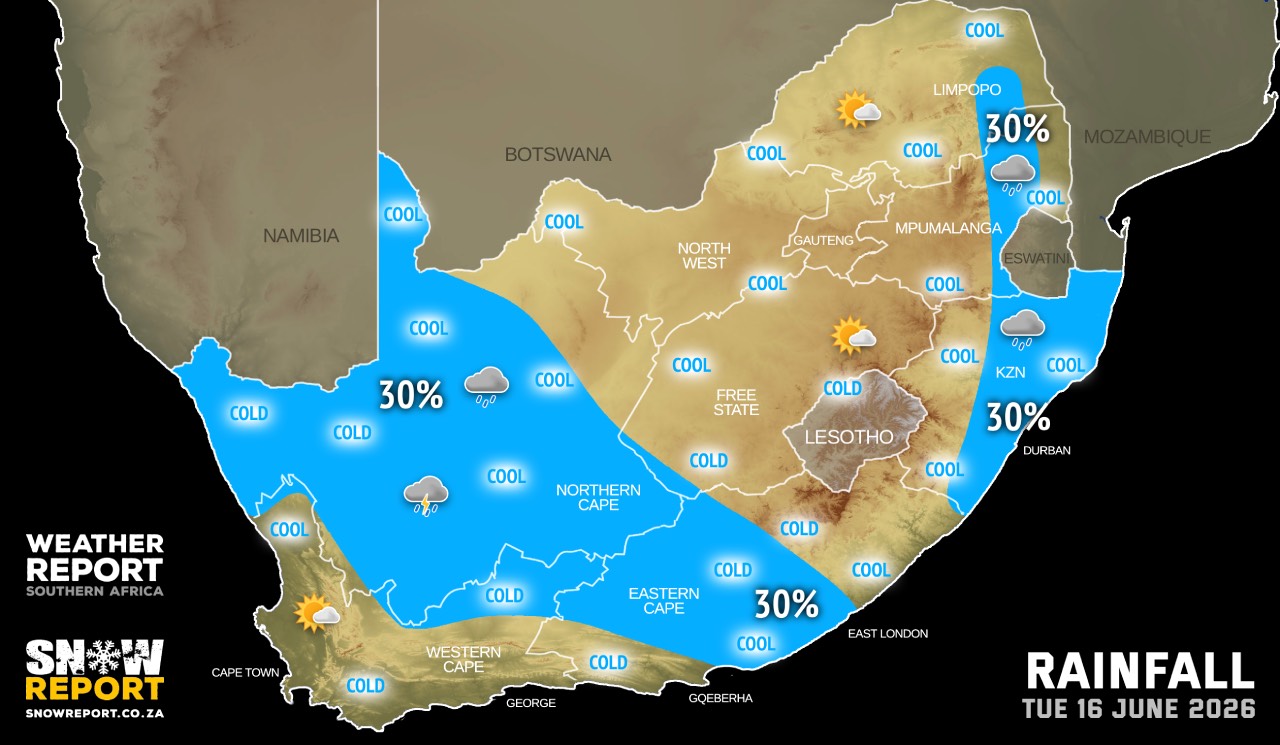
This forecast is for: Tue 16 June 2026
The maps cover: Tue 16 Jun – Sat 20 Jun
| SHARE TO |
A cut-off low is expected to influence the central and western interior of South Africa from Tuesday afternoon.
The system is expected to impacting the Northern Cape and the Western Cape with isolated showers/thundershowers as well as windy conditions over the western interior.
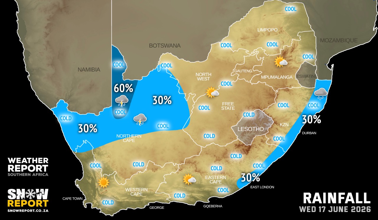
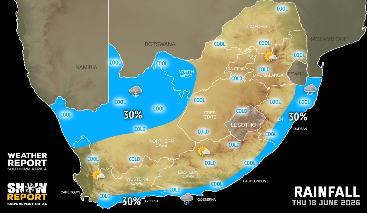
As the system progresses east, the conditions are expected to spread into the Free State and the western half of the Eastern Cape and may affect the North West from Wednesday, as well as Gauteng and neighbouring provinces on Friday and Saturday.
A drop in day-time temperatures is expected due to this weather system.
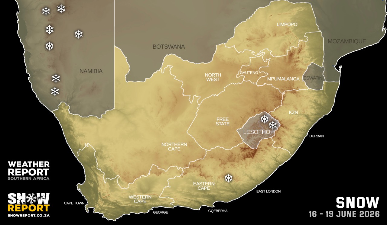
A notable amount of snowfall is possible for Namibia from Wednesday until Friday, as per the map above. Snow is possible between Aus and Rosh Pinah in the south, as well as the higher ground in the central part of the country as far up as just west of Windhoek.
Warnings from the SA Weather Service:
No warnings for now.
This outlook may be updated as more information becomes available.
| SHARE TO |
Please be sure to send photos and videos to us via whatsapp and also tell us where and when they were taken.
Follow our channels