
 Swipe left or right for more maps, and see below for others
Cold in places on Tuesday with showers in the westBy Staff WriterPublished: 28 July 2025 [updated 29 July] This forecast is for: Tue 29 July 2025 The maps cover: Tue 29 Jul – Thu 31 Jul
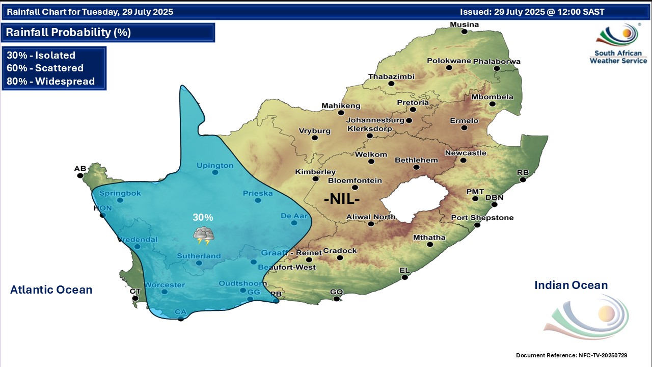
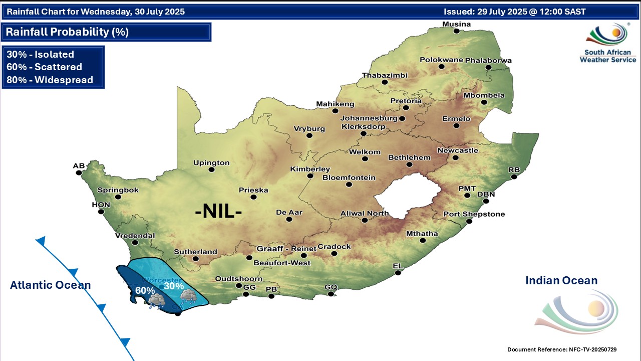
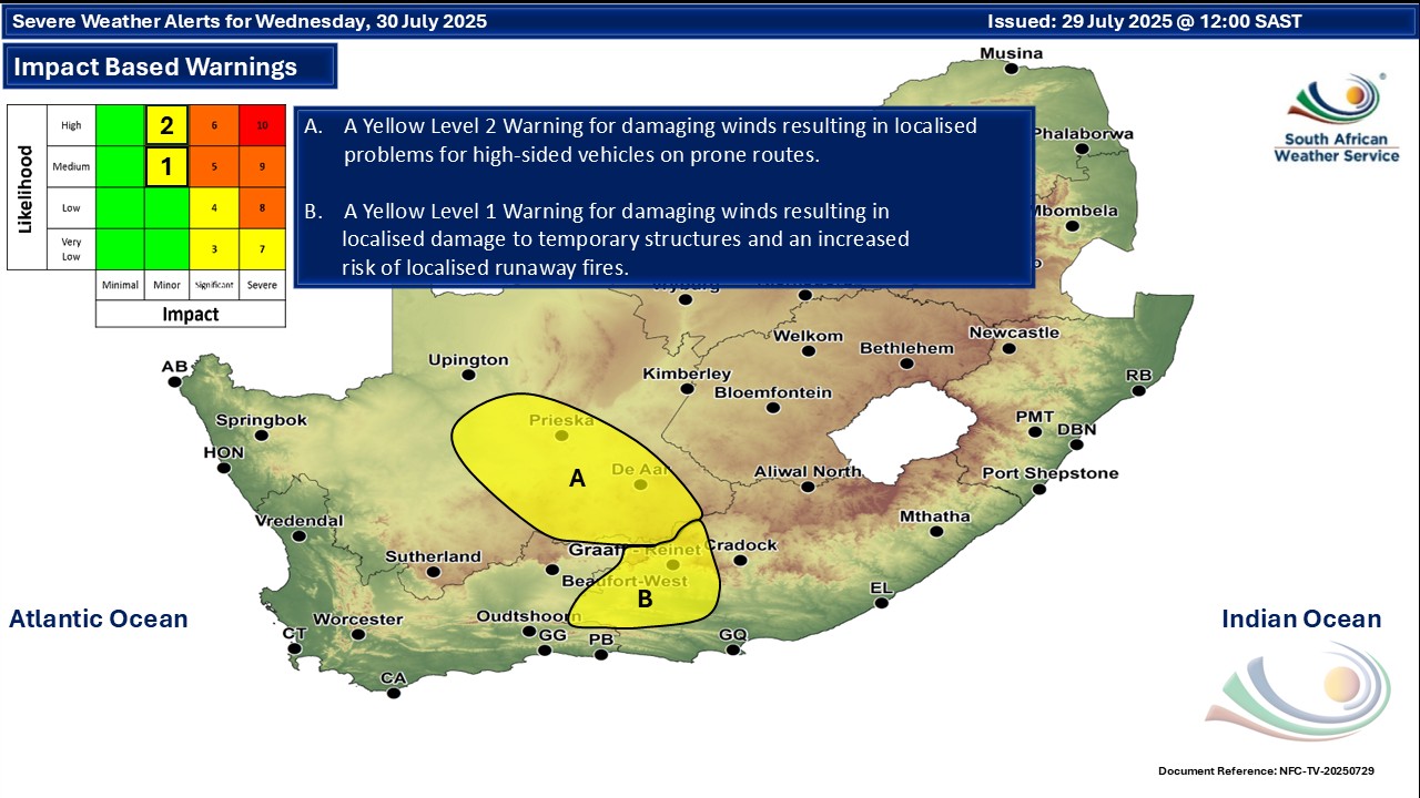
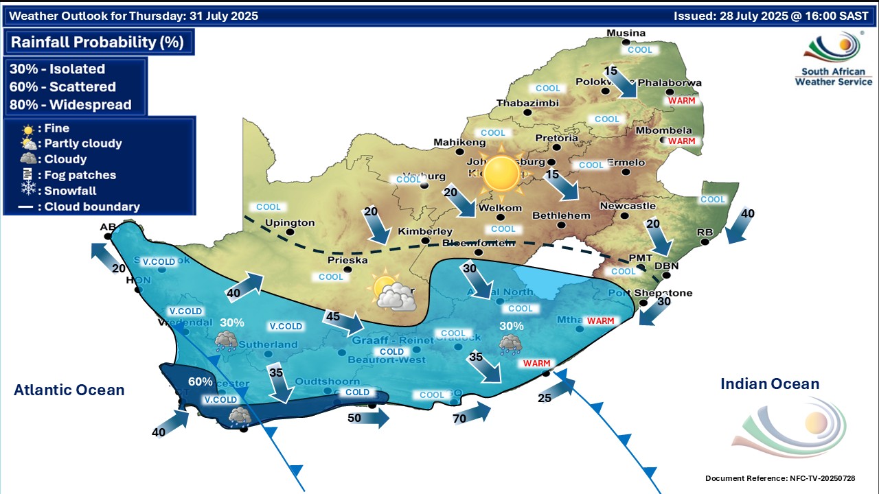
A newer forecast is available by clicking here. You can listen to this daily weather forecast as a 3 minute podcast by pressing the > play button above. Showers are now possible in the Western Cape as well as the Northern Cape later on Tuesday, according to the lunchtime update from the SA Weather Service. Fine and cold to cool but cloudy with isolated to scattered showers and rain in the south-west on Wednesday, spreading to the west and southern interior by Thursday. SEE ALSO: More low-level snowfall in a few SA provinces and Lesotho on Thursday. Warnings from the SA Weather Service for Tuesday: Extremely high fire danger conditions are expected over the Swellendam and Hassequa municipalities of the Western Cape. Warnings from the SA Weather Service for Wednesday: A. level 2 warning for damaging winds over parts of the Northern Cape as per the map below. B. level 1 warning for damaging winds over parts of the Western Cape and Eastern Cape as per the map below. Regional forecasts from the SA Weather Service for Tuesday: 1. GAUTENG Fine and cool. The expected UVB sunburn index: High 2. MPUMALANGA Fine and cool but cold in places. 3. LIMPOPO Fine and cold to cool. 4. NORTH WEST Fine and cool. 5. FREE STATE Fine and cool but cold in the south-east. 6. NORTHERN CAPE Cloudy along the coast, otherwise partly cloudy, windy and cool to warm with isolated showers and thundershowers, except in the north-east. It will be hot in the extreme north-west. The wind along the coast will be moderate to fresh north-westerly. 7. WESTERN CAPE Cloudy in the west in the morning, otherwise partly cloudy and warm. Evening fog patches can be expected in the north-west. The wind along the coast will be moderate to fresh northerly to north-westerly. The expected UVB sunburn index: Moderate 8. WESTERN HALF OF THE EASTERN CAPE Fine and cool, but warm along the coast. The wind along the coast will be moderate northerly to north-westerly. 9. EASTERN HALF OF THE EASTERN CAPE Fine and cool, but warm in the south-west. The wind along the coast will be moderate to fresh north-easterly. 10. KWAZULU-NATAL Fine and cold. The wind along the coast will be fresh to strong north-easterly. The expected UVB sunburn index: Very High Travellers forecasts from the SA Weather Service for Tuesday: PRETORIA Fine. Minimum/Maximum: 03/18°C The expected UVB Sunburn Index: High JOHANNESBURG Fine. Minimum/Maximum: 04/18°C VEREENIGING Fine. Minimum/Maximum: 01/18°C MBOMBELA Fine. Minimum/Maximum: 04/17°C POLOKWANE Fine. Minimum/Maximum: 01/15°C MAHIKENG Fine. Minimum/Maximum: 07/18°C VRYBURG Fine. Minimum/Maximum: 03/19°C BLOEMFONTEIN Fine. Minimum/Maximum: 02/17°C KIMBERLEY Fine. Minimum/Maximum: 02/20°C UPINGTON Partly cloudy and windy with isolated showers and thundershowers. Minimum/Maximum: 06/23°C CAPE TOWN Partly cloudy. Wind: Moderate to fresh north-westerly. Minimum/Maximum: 13/25°C The expected UVB Sunburn Index: Moderate GEORGE Partly cloudy. Wind: Moderate to fresh northerly. Minimum/Maximum: 07/28°C GQEBERHA Fine. Wind: Moderate northerly to north-westerly. Minimum/Maximum: 11/25°C EAST LONDON Fine. Wind: Moderate to fresh north-easterly. Minimum/Maximum: 10/25°C DURBAN Fine. Wind: Fresh to strong northerly to north-easterly. Minimum/Maximum: 13/22°C The expected UVB Sunburn Index: Very High RICHARDS BAY Fine. Wind: Fresh to strong northerly to north-easterly. Minimum/Maximum: 11/22°C PIETERMARITZBURG Fine. Minimum/Maximum: 04/22°C This forecast is usually updated a few times per day.
Please be sure to send photos and videos to us via whatsapp and also tell us where and when they were taken. Follow our channels
Maps for Wednesday 30 July
  Maps for Thursday 31 July
|