
  Swipe left or right for more maps, and see below for others
A pleasant and mild weekend ahead with no weather warnings for SaturdayBy Staff WriterPublished: 25 April 2025 [updated 26 April] This forecast is for: Sat 26 April 2025 The maps cover: Sat 26 Apr – Mon 28 Apr
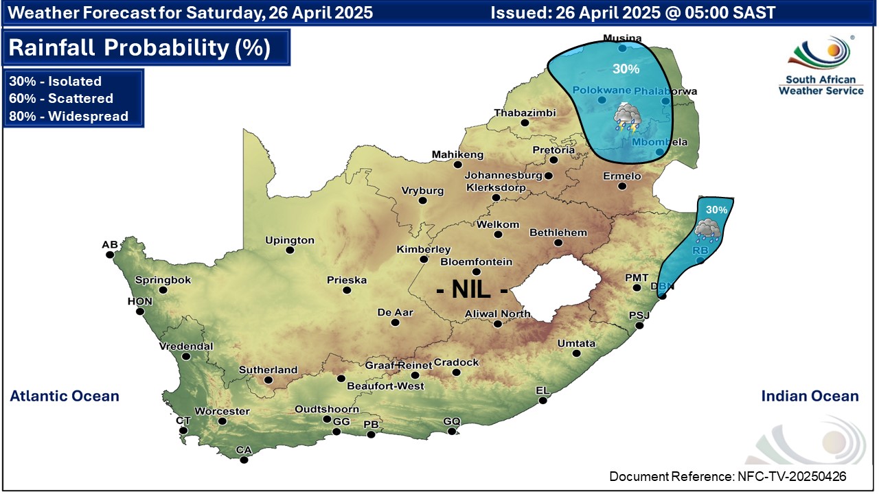
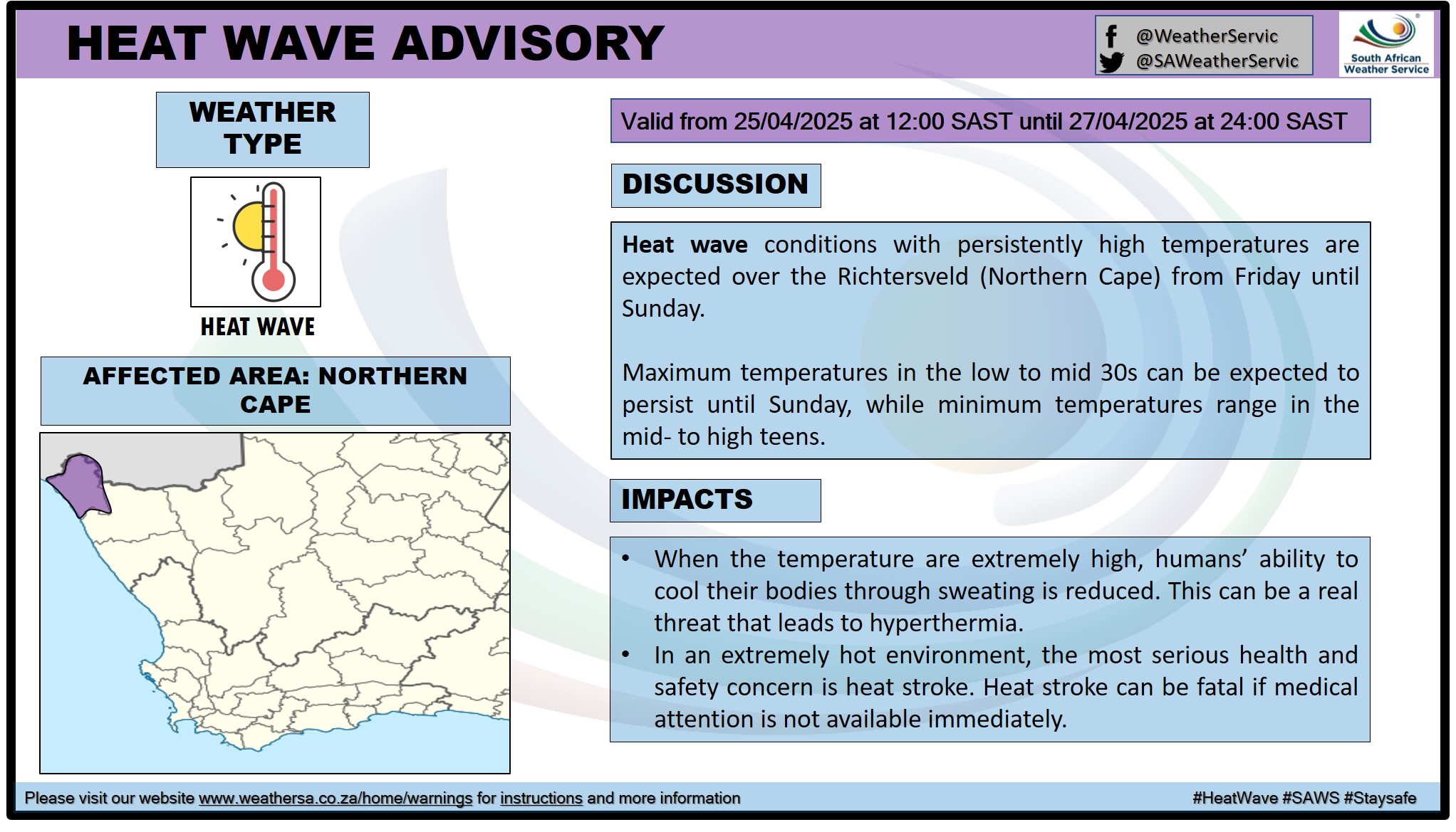
A newer forecast is available by clicking here. Fine in the west, otherwise partly cloudy and cool to warm with isolated showers and thundershowers in places in the north-east, according to the SA Weather Service. A heat wave with persistently high temperatures in Richtersveld municipality in the Northern Cape is expected until Sunday. Warnings from the SA Weather Service for Saturday: Extremely high fire danger conditions are expected in places over the north-western parts of Western Cape. Regional forecasts from SAWS for Saturday: 1. GAUTENG Partly cloudy and cool. The expected UVB sunburn index: High 2. MPUMALANGA Morning fog along the escarpment, otherwise partly cloudy and cool to warm with isolated showers and thundershowers in the extreme north. 3. LIMPOPO Partly cloudy and cool to warm with isolated showers and thundershowers over the south-western parts. 4. NORTH-WEST PROVINCE Fine and cool to warm, becoming partly cloudy in the afternoon. 5. FREE STATE Morning fog patches in the east and along the Lesotho border, otherwise partly cloudy and cool. 6. NORTHERN CAPE Fine and cool to warm, but hot over the north-western parts. The wind along the coast will be moderate south-easterly. 7. WESTERN CAPE Morning fog along the south-western and southern coast, otherwise fine and warm to hot but cool in places. The wind along the coast will be moderate to fresh north-easterly along the west coast in the morning, otherwise light to moderate south-easterly but fresh along the south-west coast. The expected UVB sunburn index: Very High 8. WESTERN HALF OF THE EASTERN CAPE Fine and warm. The wind along the coast will be light northerly becoming light south-easterly in the afternoon. 9. EASTERN HALF OF THE EASTERN CAPE Fine and warm with evening fog along the coast and adjacent interior. The wind along the coast will be light to moderate north-easterly. 10. KWAZULU-NATAL Cloudy and cool with isolated morning showers along the coast. The wind along the coast will be moderate to fresh southerly to south-easterly but strong south-westerly in the extreme north. The expected UVB sunburn index: High Travellers forecasts from SAWS for Saturday: PRETORIA Partly cloudy. Minimum/Maximum: 11/20°C The expected UVB Sunburn Index: High JOHANNESBURG Partly cloudy. Minimum/Maximum: 9/21°C VEREENIGING Partly cloudy. Minimum/Maximum: 8/20°C MBOMBELA Partly cloudy with isolated showers and thundershowers. Minimum/Maximum: 15/22°C POLOKWANE Partly cloudy with isolated showers and thundershowers. Minimum/Maximum: 12/23°C MAHIKENG Fine, becoming partly cloudy in the afternoon. Minimum/Maximum: 9/24°C VRYBURG Fine. Minimum/Maximum: 8/23°C BLOEMFONTEIN Fine, becoming partly cloudy in the afternoon. Minimum/Maximum: 9/22°C KIMBERLEY Fine, becoming partly cloudy in the afternoon. Minimum/Maximum: 11/24°C UPINGTON Fine. Minimum/Maximum: 12/28°C CAPE TOWN Early morning fog patches, otherwise fine. Wind: Light and variable. Minimum/Maximum: 16/29°C The expected UVB Sunburn Index: Very High GEORGE Morning fog, otherwise cloudy to partly cloudy, becoming fine from the evening. Wind: Light and variable. Minimum/Maximum: 13/25°C GQEBERHA Fine Wind: Light northerly becoming light south-easterly in the afternoon. Minimum/Maximum: 16/26°C EAST LONDON Fine becoming cloudy with evening fog patches. Wind: Light to moderate north easterly Minimum/Maximum: 17/26°C DURBAN Cloudy with morning showers, becoming partly cloudy in the afternoon. Wind: Moderate to fresh southerly to south-easterly. Minimum/Maximum: 18/24°C The expected UVB Sunburn Index: High RICHARDS BAY Cloudy with morning showers, becoming partly cloudy in the afternoon. Wind: Moderate to fresh southerly to south-westerly. Minimum/Maximum: 18/24°C PIETERMARITZBURG Morning fog, otherwise partly cloudy. Minimum/Maximum: 11/22°C This forecast is usually updated a few times per day.
Please be sure to send photos and videos to us via whatsapp and also tell us where and when they were taken. Follow our channels
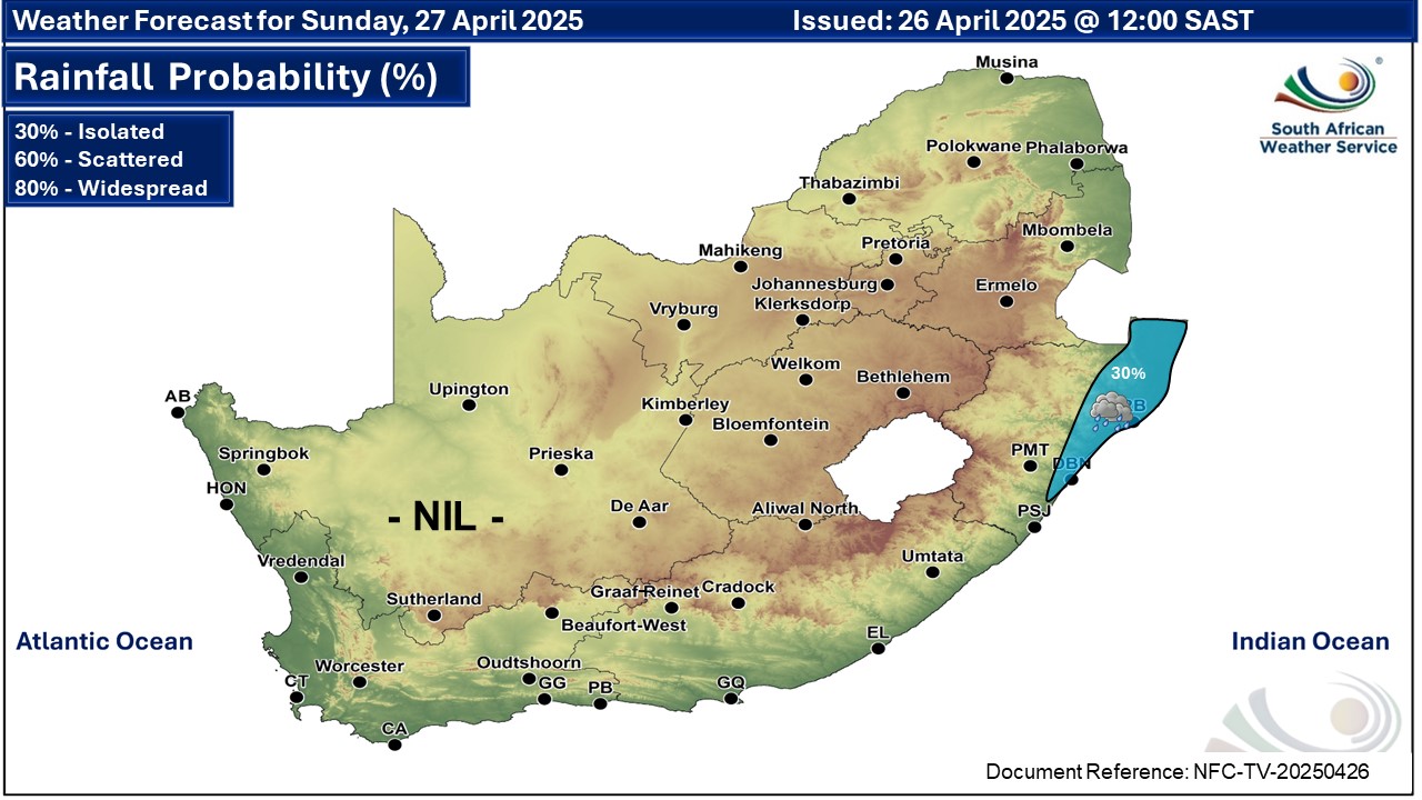
Maps for Sunday 27 April
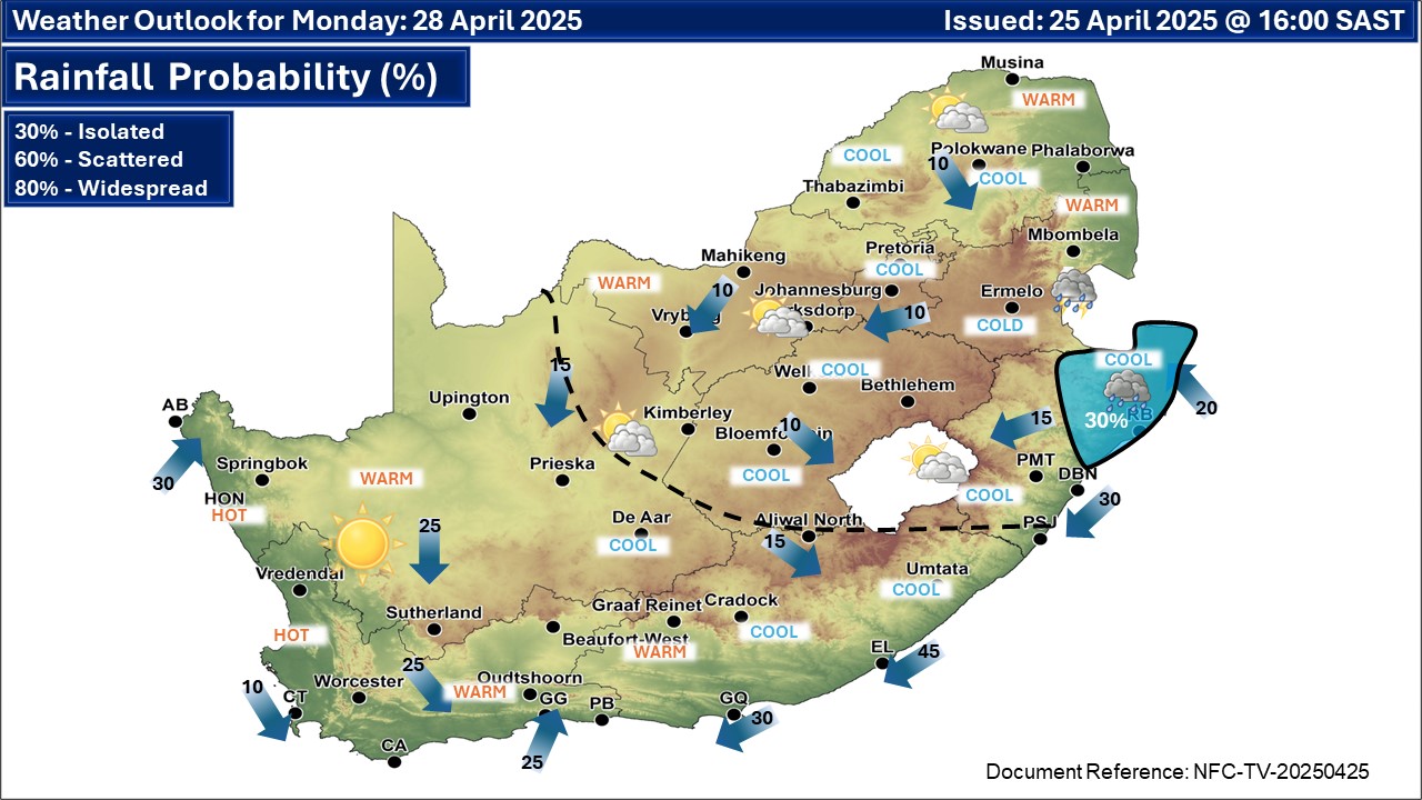
 Maps for Monday 28 April
|