
MONDAY WEATHER: Fog, isolated showers in a few places and a chance of snow
By Staff WriterPublished: 14 June 2026
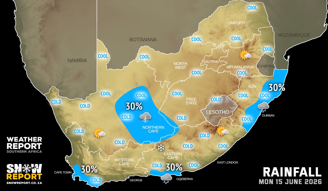
This forecast is for: Mon 15 June 2026
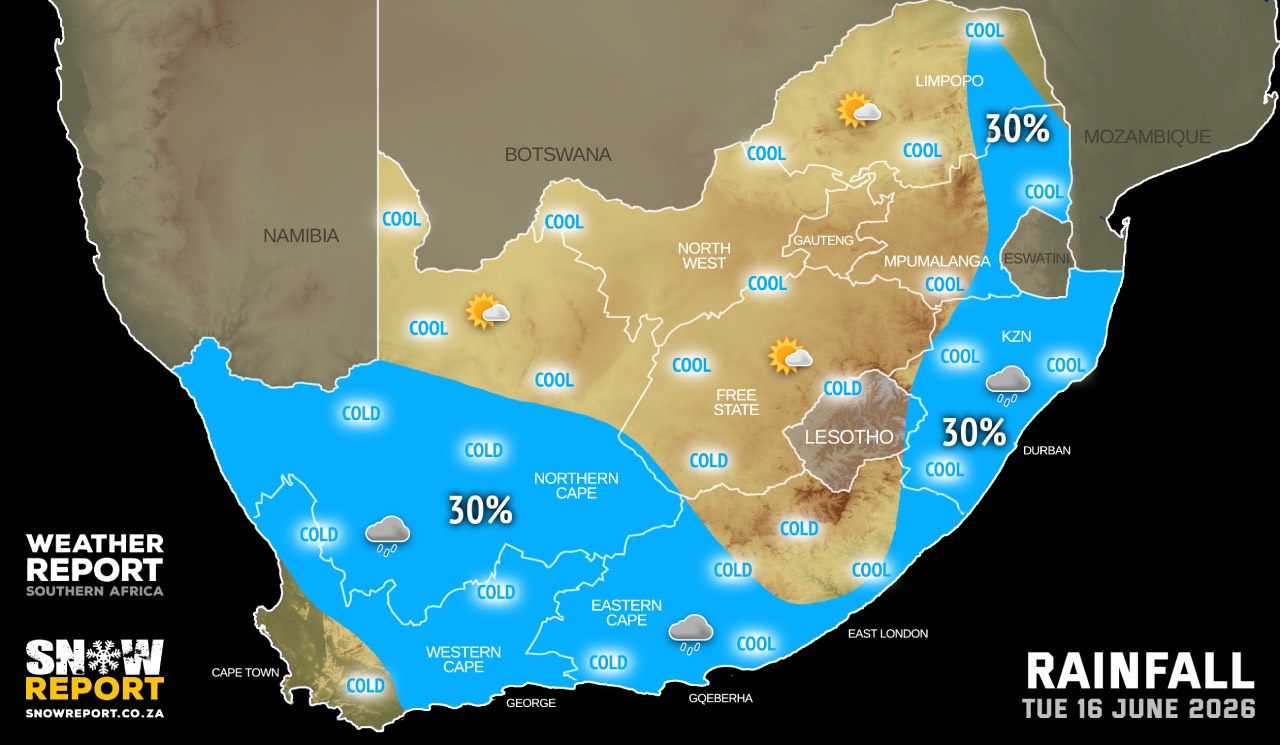
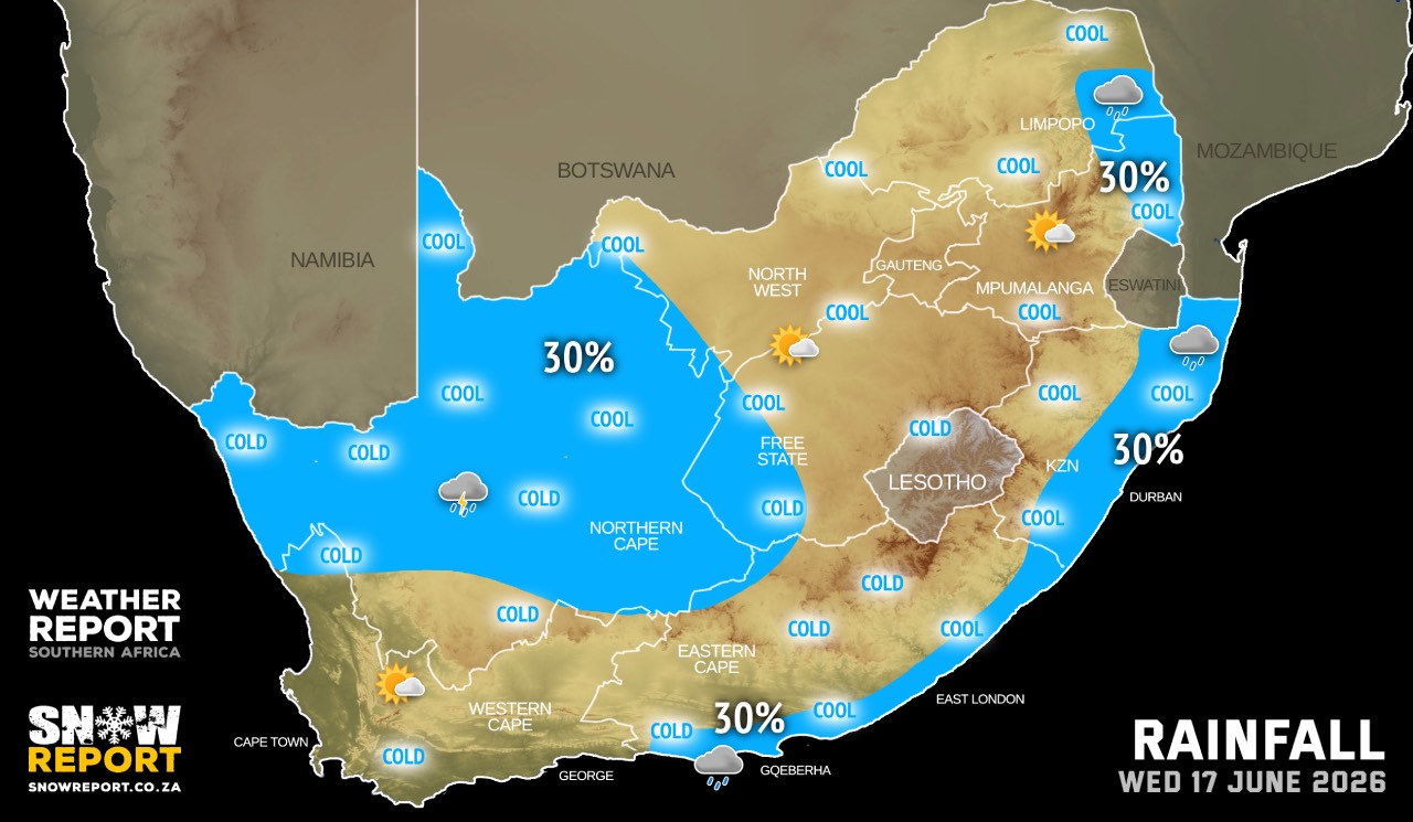
The maps cover: Mon 15 Jun – Wed 17 Jun
| SHARE TO |
Very cold conditions are expected over the southern parts of Namakwa of the Northern Cape as well as over the Witzenberg Municipality and Central Karoo District of The Western Cape.
A light dusting of snow is possible to the north and east of Graaff-Reinet in the Eastern Cape, including on the Lootsberg Pass.
Warnings from the SA Weather Service:
No warnings for now.
Regional forecasts from the SA Weather Service for Monday:
GAUTENG
Fine and Cool.
MPUMALANGA
Fine and cool, but warm in the Lowveld.
LIMPOPO
Fine and cool, but warm in the east.
NORTH-WEST
Fine and cool.
THE FREE STATE
Partly cloudy in the south, otherwise fine and cold to cool.
THE NORTHERN CAPE
Morning fog along the coast, otherwise cloudy to partly cloudy and cold to cool with isolated evening showers and thundershowers in the south-east. It will be fine in the north-east. The wind along the coast will be moderate south-easterly becoming fresh to strong in the afternoon.
THE WESTERN CAPE
Morning fog in places in the west, otherwise cloudy to partly cloudy and cool to cold with light rain in the southwest at first. It will become fine in the west from the afternoon. The wind along the coast will be light and variable but moderate to fresh along the south and south-west coast at first. It will become moderate to fresh south-easterly along the west and south-west coast from the afternoon.
THE WESTERN HALF OF THE EASTERN CAPE
Partly cloudy and cool becoming cloudy with afternoon showers of rain along the South Coast west of Cape St Francis. The wind along the coast will be fresh south-westerly.
THE EASTERN HALF OF THE EASTERN CAPE
Partly cloudy and cool to cold in the north. The wind along the coast will be fresh south-westerly.
KWAZULU-NATAL
Fine and cool to warm, becoming partly cloudy with isolated showers and rain in the east. The wind along the coast will be moderate to fresh northerly to north-easterly north of Durban, but moderate to fresh south-westerly in the south, spreading northwards and reaching Kosi Bay at night.
Travellers forecasts from the SA Weather Service for Monday:
PRETORIA
Fine.
Minimum/Maximum: 10/22°C
JOHANNESBURG
Fine.
Minimum/Maximum: 09/20°C
VEREENIGING
Fine.
Minimum/Maximum: 08/21°C
MBOMBELA
Fine.
Minimum/Maximum: 12/23°C
POLOKWANE
Fine.
Minimum/Maximum: 08/20°C
MAHIKENG
Fine.
Minimum/Maximum: 08/21°C
VRYBURG
Fine
Minimum/Maximum: 07/23°C
BLOEMFONTEIN
Fine.
Minimum/Maximum: 06/20°C
KIMBERLEY
Fine, becoming partly cloudy by the afternoon.
Minimum/Maximum: 07/22°C
UPINGTON
Partly cloudy.
Minimum/Maximum: 05/21°C
CAPE TOWN
Morning fog patches, otherwise cloudy with light rain in the morning, becoming partly cloudy from the afternoon.
Wind: light and variable, becoming moderate south-easterly from the afternoon.
Minimum/Maximum: 12/16°C
GEORGE
Cloudy, becoming partly cloudy from the afternoon.
Wind: moderate north-westerly, becoming south-westerly in the afternoon.
Minimum/Maximum: 09/15°C
GQEBERHA
Partly cloudy, becoming cloudy with showers of rain in the afternoon.
Wind: Fresh south-westerly.
Minimum/Maximum: 12/18°C
EAST LONDON
Partly cloudy.
Wind: Fresh south-westerly.
Minimum/Maximum: 13/18°C
DURBAN
Fine becoming partly cloudy in the afternoon with isolated evening showers and rain.
Wind: Light to moderate south-westerly, becoming fresh in the afternoon.
Minimum/Maximum: 16/23°C
RICHARDS BAY
Fine becoming partly cloudy in the afternoon with isolated evening showers and rain.
Wind: Moderate northerly to north-easterly, becoming moderate south-westerly in the afternoon.
Minimum/Maximum: 15/24°C
PIETERMARITZBURG
Fine becoming partly cloudy in the afternoon with isolated evening showers and rain.
Minimum/Maximum: 11/20°C
This forecast is usually updated a few times per day.
| SHARE TO |
Please be sure to send photos and videos to us via whatsapp and also tell us where and when they were taken.
Follow our channels