
More snowfall possible in the Western Cape and around Sutherland on SaturdayBy Staff WriterPublished: 8 August 2025 This forecast covers: Sat 09 Aug – Sat 09 Aug
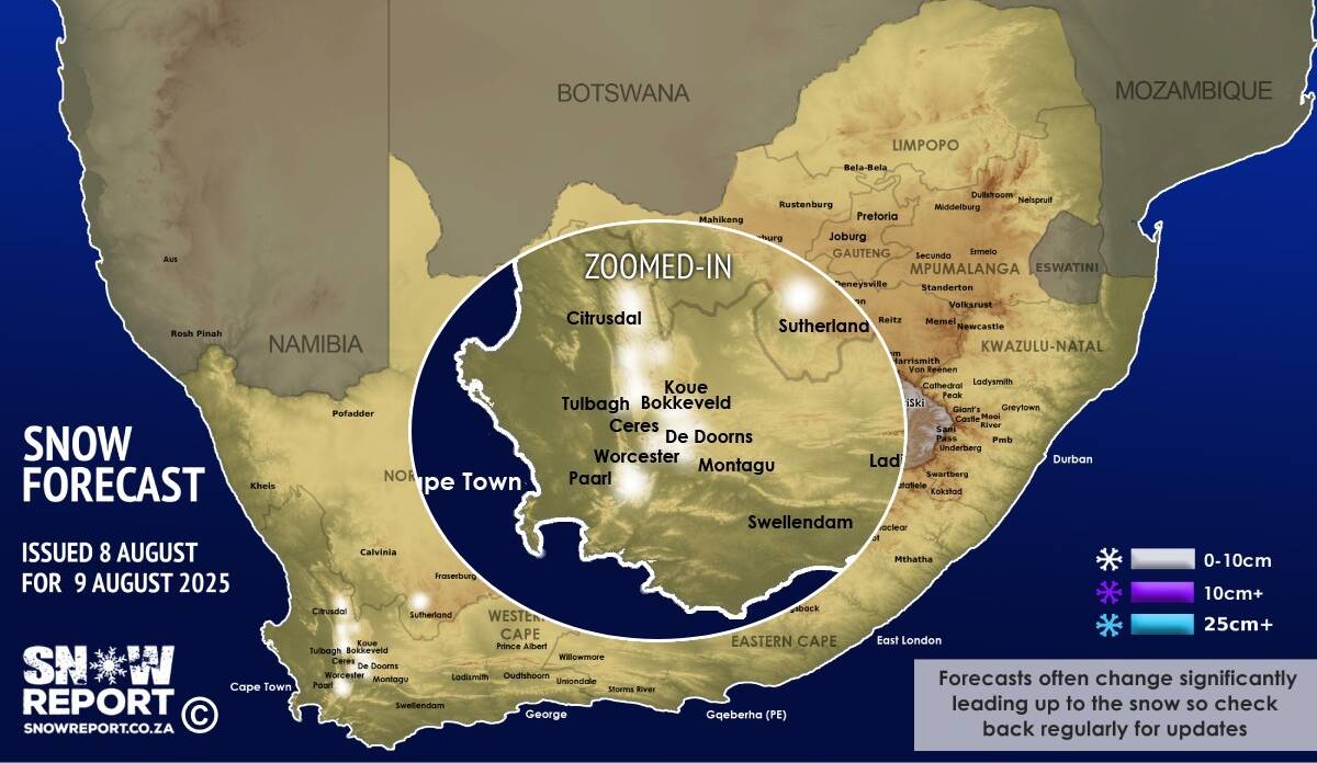
Light snow is possible again mainly on the Western Cape peaks on Saturday, as per the map above. Many of the Western Cape peaks may receive some snowfall from the afternoon and into the evening on Saturday this weekend. This includes the peaks around Stellenbosch, Paarl, Wellington, Franschhoek, Tulbagh, Worcester, De Doorns, Robertson, Ceres, the Koue Bokkeveld and the Cederberg. There is also a chance of some very light snowfall on the high-ground around Sutherland in the Western Cape, but probably not in the town itself. No low-level snow is expected. If you are planning to travel through areas that may get snow this winter it is worth being prepared by reading our article on safe winter travel. The map indicates where we are seeing the possibility of snow, but it may not fall in all of the areas shown on the map. As with any forecast of any kind (temperature, clouds, rain, wind), what eventually happens may or may not be similar to the forecast. Snow indicated may reduce or vanish completely in some areas, or the dates and times may change. Follow our channels
Standard users are welcome to use the standard sharing buttons on this page to share our content. It is NOT acceptable to download or screen grab for reposting. Other media and channels need to send us a request in order to embed or use of our forecasts, maps, as well as images and video from our users that we post (before doing so).
|