
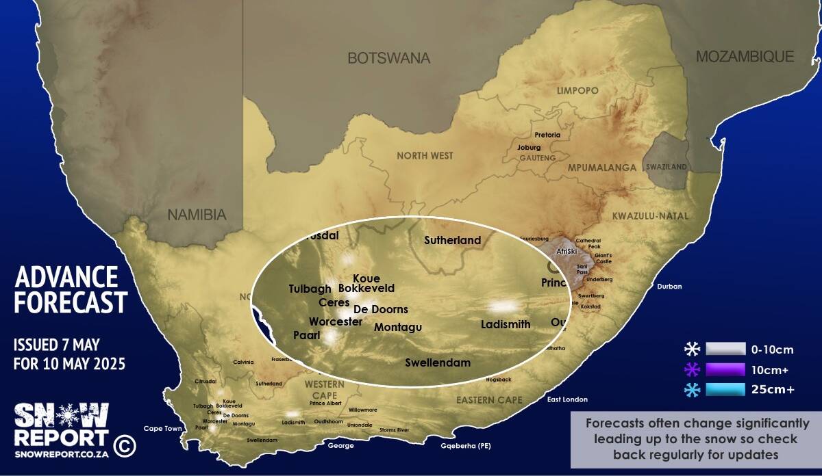
Light snowfall possible in the Western Cape this weekendBy Staff WriterPublished: 7 May 2025 This forecast covers: Sat 10 May – Sun 11 May
Very light snowfall is possible on the Western Cape peaks on Saturday and overnight into Sunday. Very cold, wet and windy conditions are expected over parts of the Northern Cape and Western Cape on Saturday. The high peaks around regular snow areas such as Franschhoek, Paarl, Tulbagh, Worcester, De Doorns, Ceres, the Cederberg, the Koue Bokkeveld and parts of the Swartberg range in the Western Cape might get a light dusting of snow. NO low-level snow is currently expected anywhere this weekend. This is still an advance forecast and we will update again before the weekend. If you are planning to travel through areas that may get heavy snow sometimes it is worth being prepared by reading our article on safe winter travel. The map indicates where we are seeing the possibility of snow, but it may not fall in all of the areas shown on the map. As with any forecast of any kind (temperature, clouds, rain, wind), what eventually happens may or may not be similar to the forecast. Snow indicated may reduce or vanish completely in some areas, or the dates and times may change. Follow our channels
Standard users are welcome to use the standard sharing buttons on this page to share our content. It is NOT acceptable to download or screen grab for reposting. Other media and channels need to send us a request in order to embed or use of our forecasts, maps, as well as images and video from our users that we post (before doing so).
|