
![Snow forecast map for 28 June 2026 [updated 1 July]](/img/SR-Map-1-July-2026-F2-cropped.jpg)
Disruptive snow on the radar for Thursday – a warning has been issuedBy Staff WriterPublished: 28 June 2026 [updated 1 July] This forecast covers: Wed 01 Jul – Thu 02 Jul
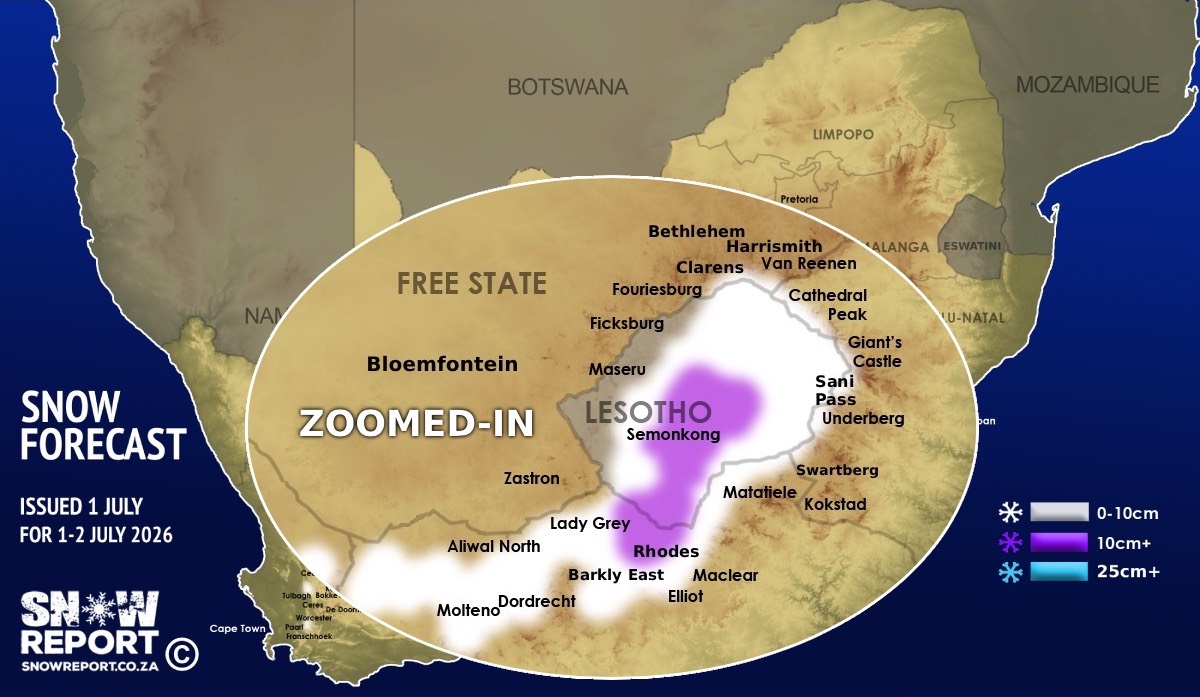
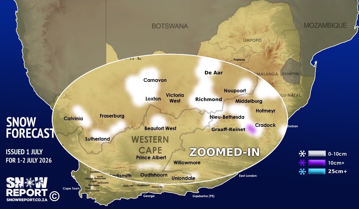
Snowfall is possible from Wednesday and through Thursday as per the map, with the main snow day being Thursday. Note the zoomed-in maps at the bottom of this page that show more detail. Light snowfall is currently indicated in the Western Cape high-ground or peaks around Paarl, Franschhoek, Worcester, Wellington, Ceres and De Doorns. Light snowfall is also indicated on the high-ground around Beaufort West and Uniondale, and on the Swartberg mountains between Oudtshoorn, De Rust and Prince Albert. Very light snow is also indicated at higher elevations around Sutherland, Calvinia, Loxton, Carnavon, Richmond, De Aar, Noupoort and other areas marked on the maps in the Northern Cape. In the Eastern Cape light snow is currently indicated on the high ground around places such as Middelburg, Nieu-Bethesda, Graaff-Reinet, Cradock, Molteno, Dordrecht, Burgersdorp, Aliwal North, Hogsback and Willowmore while slightly more snow is on the radar for higher elevations around Barkly East and Lady Grey, with up to 15cm indicated at high elevations around Rhodes. A level 2 warning has been issued for disruptive snowfall in the north-east of the Eastern Cape on Thursday – essentially around where the purple is on our map. Snow is indicated for much of the high ground in Lesotho, including around Semonkong, Afriski and the top of Sani Pass as well as on the Drakensburg and Maluti mountains with up to 15cm indicated in some areas. ALSO READ: Be prepared for safe winter travel and snow chasing trips. The map indicates where we are seeing the possibility of snow, but it may not fall in all of the areas shown on the map. As with any forecast of any kind (temperature, clouds, rain, wind), what eventually happens may or may not be similar to the forecast. Snow indicated may reduce or vanish completely in some areas, or the dates and times may change. Follow our channels
Standard users are welcome to use the standard sharing buttons on this page to share our content. It is NOT acceptable to download or screen grab for reposting. Other media and channels need to send us a request in order to embed or use of our forecasts, maps, as well as images and video from our users that we post (before doing so).
|