
 More maps below
Heavy disruptive rainfall expected to be a threat at the end of the festive season3 January 2025By Staff Writer
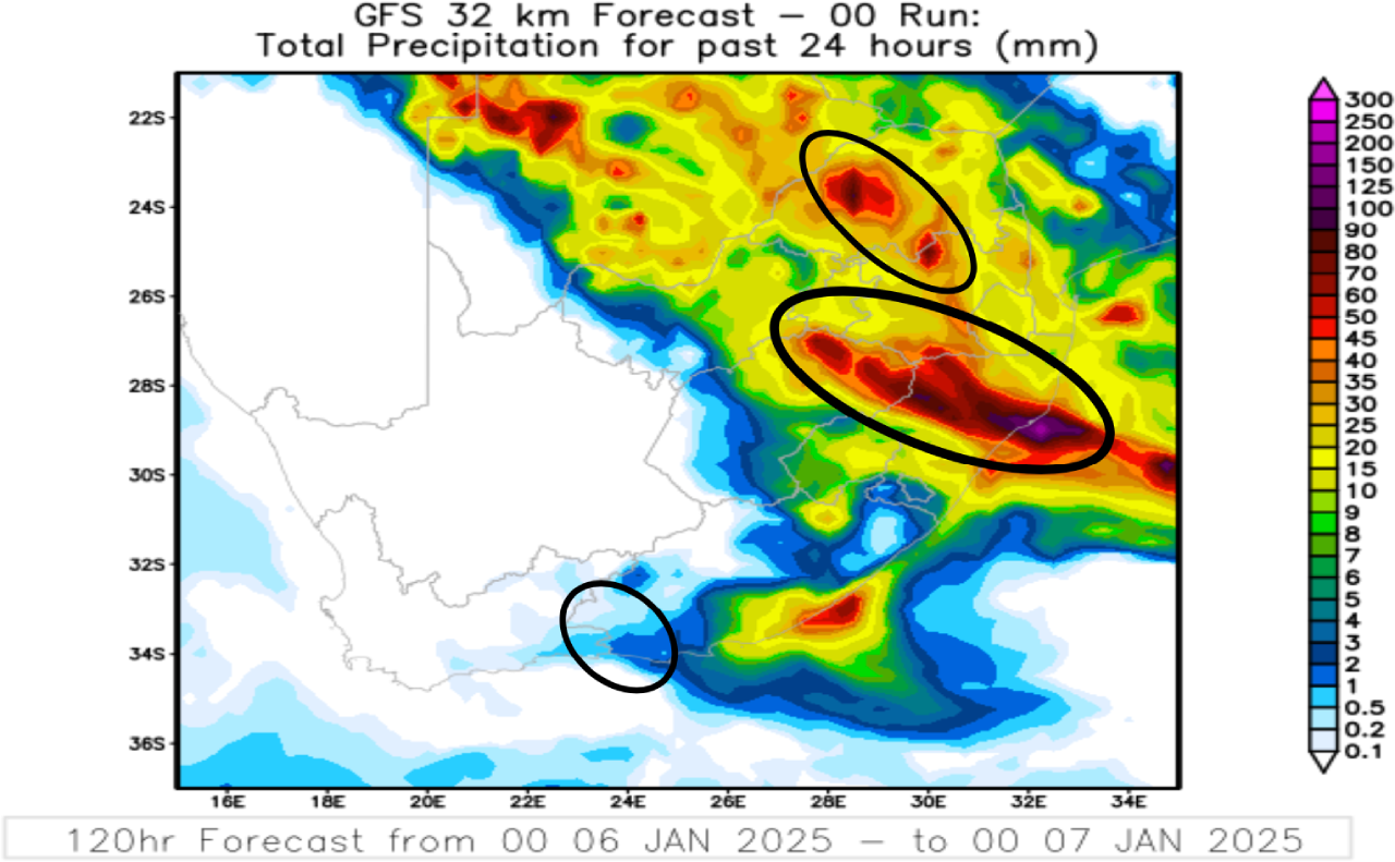
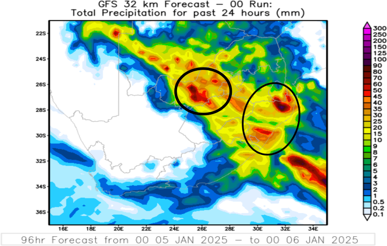
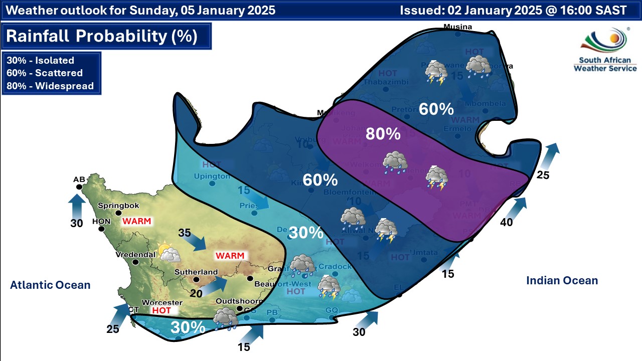
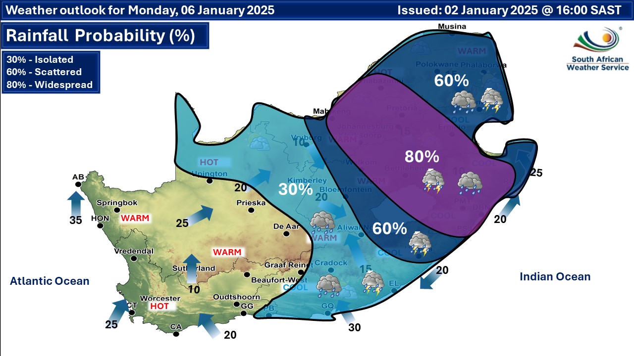
The SA Weather Service (SAWS) has alerted motorists returning to economic activities, pedestrians and the public to be aware of heavy, disruptive rainfall across the central and eastern regions of South Africa from Sunday 5 January until at least Wednesday 8 January 2025. Scattered and widespread showers and thundershowers are expected on Sunday across the central and eastern regions of the country, including North West, the Free State, KwaZulu-Natal and the southern parts of Mpumalanga and Gauteng. The likelihood of a significant increase in rainfall accumulation with amounts ranging from 50mm to 70mm may result in road flooding, slippery surfaces, and broad flash flooding. Summer thundershowers are confined to the afternoon and early evening hours, but according to SAWS the continuous flow of warm tropical moisture to South Africa from countries to the north is expected to cause showers at any time of the day. Ordinary or even heavy showers could be expected even between 6pm in the evening and 1am in the early morning. The rainfall distribution is anticipated to remain scattered to widespread across the central and eastern regions of the country on Monday and these conditions will most likely be accompanied by the persistence of disruptive rain and localised flooding across North West, the Free State, Gauteng as well as the western Bushveld of Limpopo, Mpumalanga, and KwaZulu-Natal. These adverse weather conditions are expected to persist until Wednesday over the north-eastern and eastern provinces, where potential flooding can be expected as a result of the persistent rainfall. Incidents of heavy rain are expected across the eastern regions of the country towards the middle of next week, although potentially clearing in central region according to SAWS. Authorities haved urged motorists, pedestrians and the public to be extra vigilant and careful on the roads during these conditions. ALSO READ: Three orange level disruptive rainfall warnings on Monday with flooding possible. Please be sure to send photos and videos to us via whatsapp and also tell us where and when they were taken. See below for a link to our whatsapp channel but since the link does not work in the instagram app you will need to send us a whatsapp message and we'll send you a link. Follow our channels
Standard users are welcome to use the standard sharing buttons on this page to share our content. It is NOT acceptable to download or screen grab for reposting. Other media and channels need to send us a request in order to embed or use of our forecasts, maps, as well as images and video from our users that we post (before doing so).
Related maps
   |