
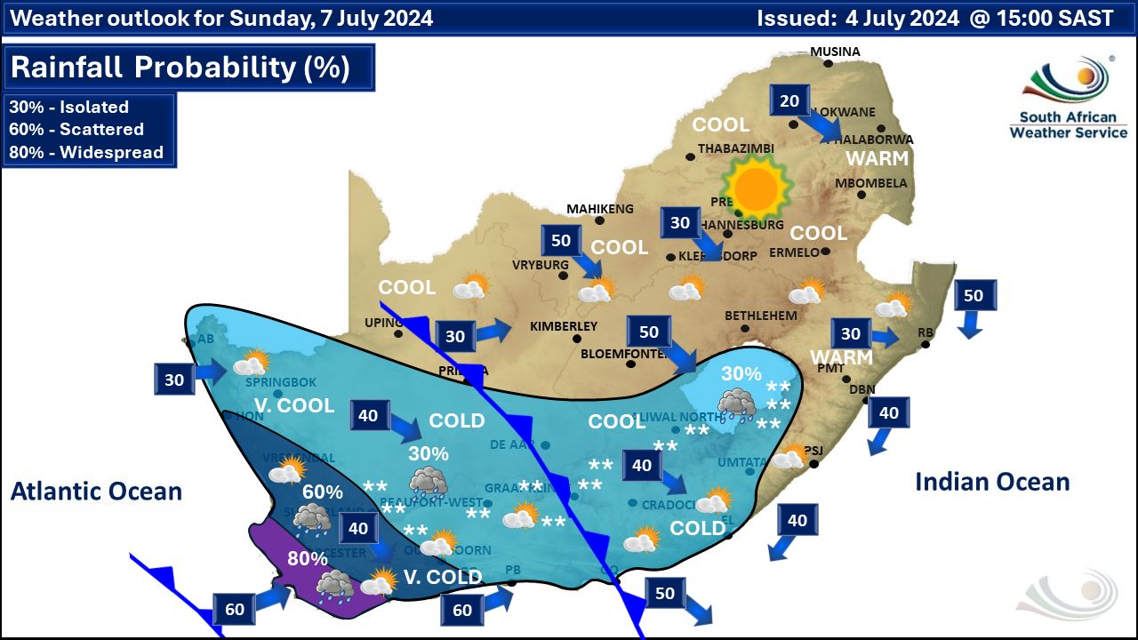
 More weather maps below the forecast
Damaging waves on Thursday as cold front brings rain and snow30 June 2024 [updated 4 July]By Staff Writer
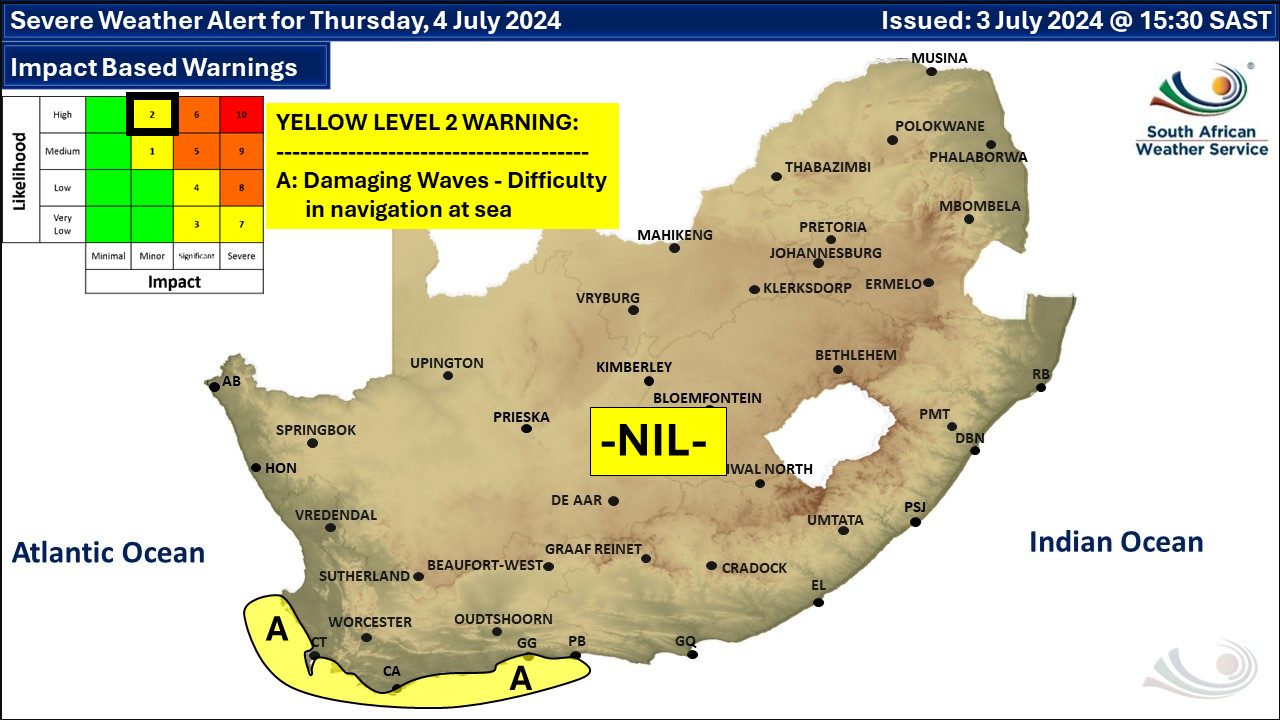
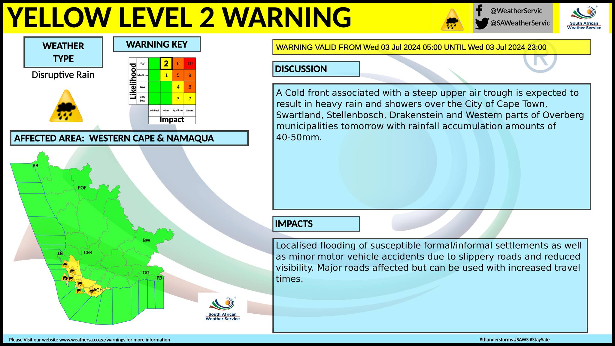
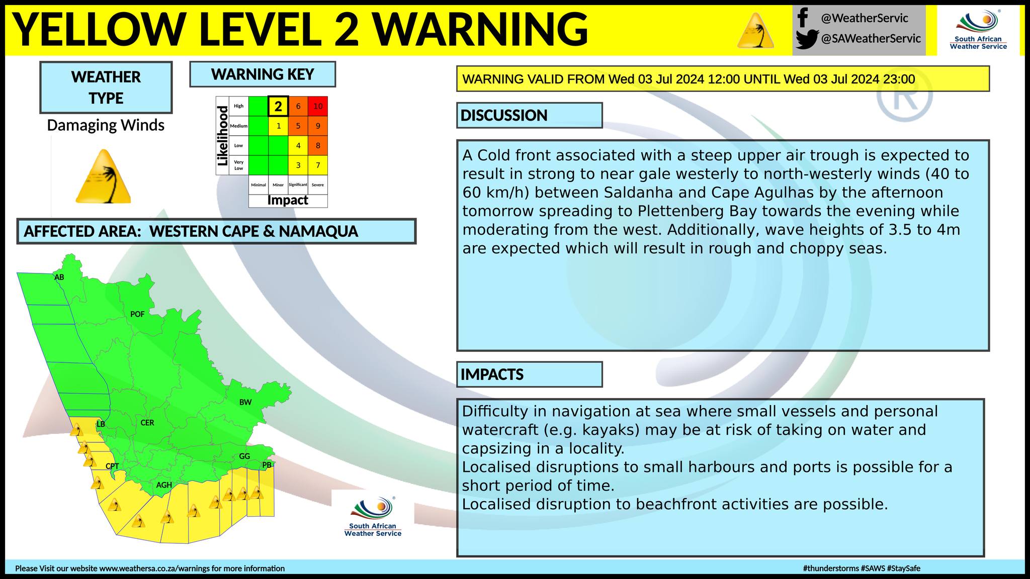
You can listen to this daily weather forecast as a 4 minute podcast by pressing the > play button above. A newer weather forecast can be found here. Patches of rain and snow on Thursday, according to the South African Weather Service (SAWS) and Snow Report Southern Africa. SAWS have issued a Yellow level 2 warning for damaging waves resulting in difficulty in navigation at sea and small vessels at risk of taking on water and capsizing between Saldanha Bay and Plettenberg Bay in the evening on Thursday. We have also posted a forecast for snow on Wednesday and Thursday here. We have also updated a forecast for heavy low-level snowfall for the weekend here. Regional forecasts from SAWS for Thursday: GAUTENG Fine and cool but warm in the north. The expected UVB sunburn index: Very High MPUMALANGA Fine and cold to cool but warm in places in the east. LIMPOPO Fine and cool to warm, but hot in places in the Lowveld and the Limpopo Valley. THE NORTH-WEST PROVINCE Fine, windy and cool to warm. THE FREE STATE Fine, windy and cold to cool becoming partly cloudy in the south. THE NORTHERN CAPE Partly cloudy in west with morning fog patches, otherwise fine, windy and cold to cool becoming partly cloudy in the south from the afternoon. The wind along the coast will be light and variable at first, otherwise moderate to fresh southerly. THE WESTERN CAPE Partly cloudy over the western parts, and along the south coast in the morning, otherwise fine and cold. Morning fog patches are expected over the West Coast, with light rain over the south-western parts from the evening. The wind along the coast will be moderate to fresh west to north-westerly, but strong at times along the south coast, while including the south-west coast from the evening, where it will reach near-gale towards midnight. The expected UVB sunburn index: Low THE WESTERN HALF OF THE EASTERN CAPE Cloudy with isolated showers over the eastern parts in the morning, otherwise fine and cold. The wind along the coast will be Fresh to strong westerly. THE EASTERN HALF OF THE EASTERN CAPE Cloudy with isolated showers in the west and light snowfalls in the north-east in the morning, otherwise partly cloudy and cold but cool along the coast. The wind along the coast will be Moderate to fresh south-westerly. KWAZULU-NATAL Fine and cool to warm, but cold in the south-west. It will become partly cloudy in the east with isolated showers along the north coast and adjacent interior. The wind along the coast will be moderate northerly to north-easterly in the north in the morning, otherwise moderate to fresh southerly to south-westerly, becoming strong to near gale from mid-morning. The expected UVB sunburn index: High Travellers forecast from SAWS for Thursday PRETORIA Fine. Minimum/Maximum: 6/21°C The expected UVB Sunburn Index: Very High JOHANNESBURG Fine. Minimum/Maximum: 5/19°C VEREENIGING Fine. Minimum/Maximum: 3/18°C MBOMBELA Fine Minimum/Maximum: 9/29°C POLOKWANE Fine Minimum/Maximum: 8/26°C MAHIKENG Fine and windy. Minimum/Maximum: 7/21°C VRYBURG Fine and windy. Minimum/Maximum: 4/20°C BLOEMFONTEIN Fine and windy. Minimum/Maximum: 4/16°C KIMBERLEY Fine and windy. Minimum/Maximum: 2/16°C UPINGTON Fine and windy. Minimum/Maximum: 4/18°C CAPE TOWN Cloudy at times with light rain from the evening. Wind: Moderate to fresh north to north-westerly. Minimum/Maximum: 11/16°C The expected UVB Sunburn Index: Low GEORGE Partly cloudy in the morning, otherwise fine. Wind: Moderate to fresh westerly. Minimum/Maximum: 9/17°C GQEBERHA Partly cloudy in the morning, otherwise fine. Wind: Fresh to strong westerly, moderating in the evening. Minimum/Maximum: 10/18°C EAST LONDON Partly cloudy in the morning, otherwise fine. Wind: Fresh to strong south-westerly, moderating in the evening. Minimum/Maximum: 12/20°C DURBAN Fine, becoming partly cloudy at times. Wind: Moderate to fresh southerly to south-westerly, becoming strong to near gale at times. Minimum/Maximum: 13/23°C The expected UVB Sunburn Index: High RICHARDS BAY Partly cloudy with isolated showers and thundershowers. Wind: Moderate to fresh southerly to south-westerly, becoming strong to near gale at times. Minimum/Maximum: 14/25°C PIETERMARITZBURG Fine. Minimum/Maximum: 6/22°C See the South African Weather Service maps below. This forecast changes regularly and updates will be issued periodically. Please be sure to send photos and videos to us via whatsapp and also tell us where and when they were taken. See below for a link to our whatsapp channel but since the link does not work in the instagram app you will need to send us a whatsapp message and we'll send you a link. Follow our channels
Standard users are welcome to use the standard sharing buttons on this page to share our content. It is NOT acceptable to download or screen grab for reposting. Other media and channels need to send us a request in order to embed or use of our forecasts, maps, as well as images and video from our users that we post (before doing so).
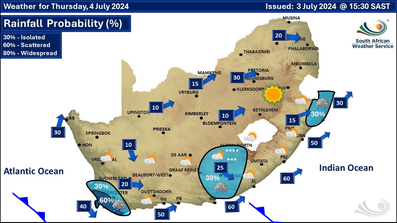
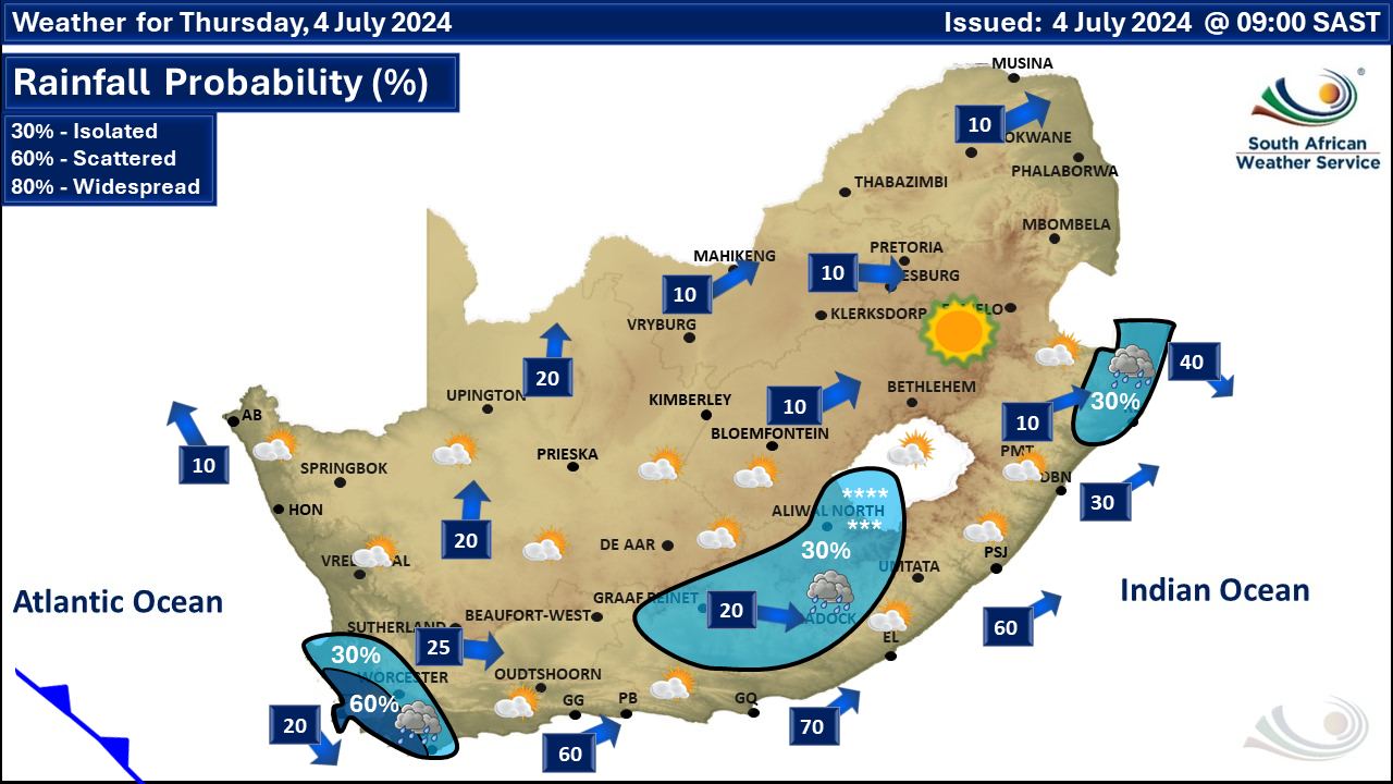
Issued on Thursday
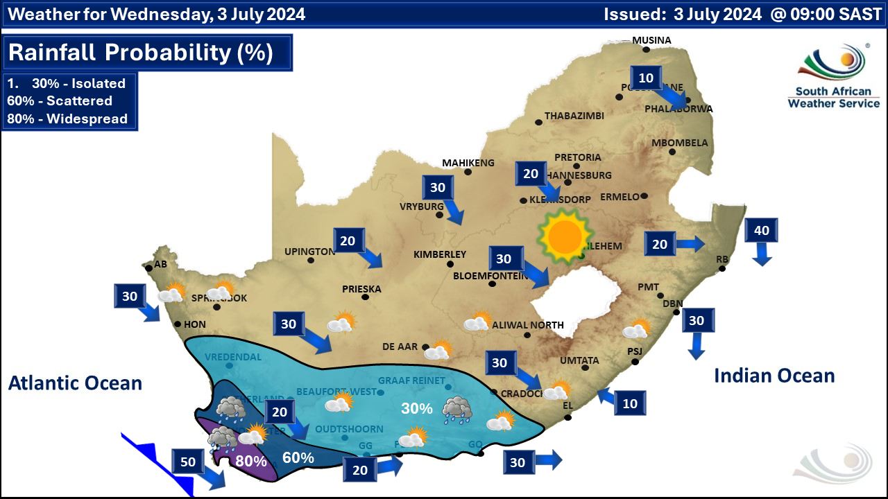
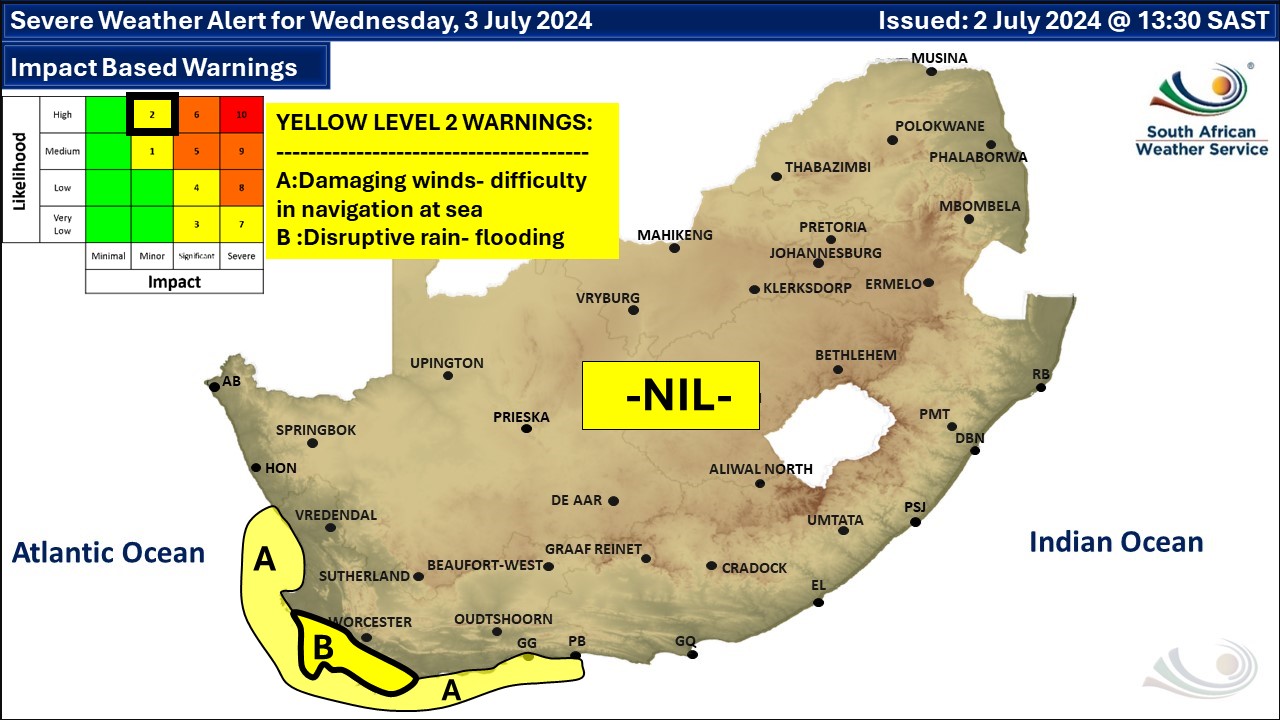
 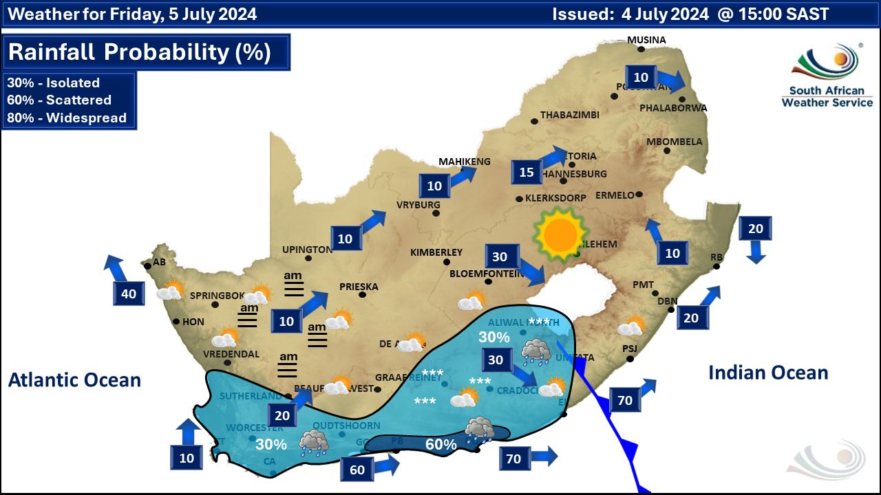   Issued on Wednesday
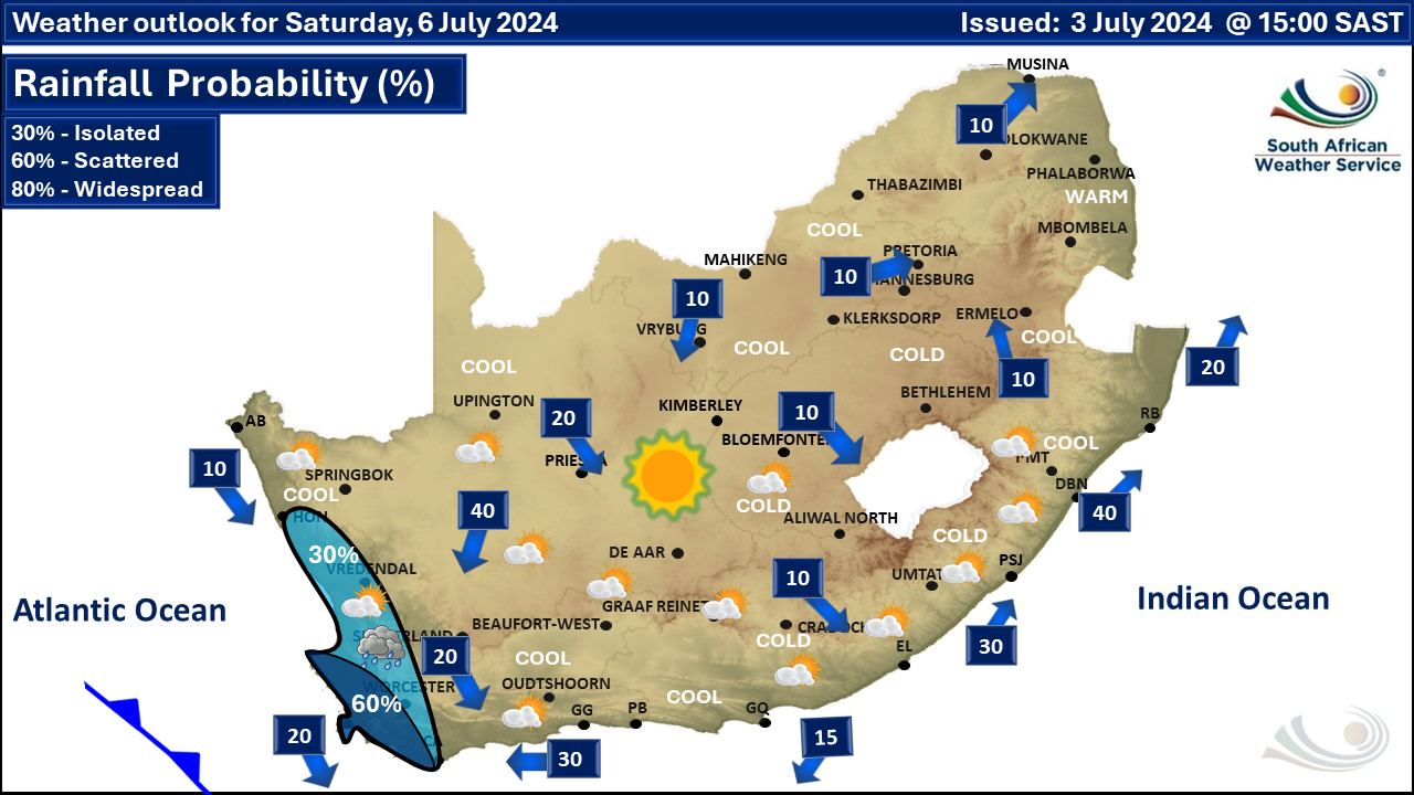
  Issued on Tuesday
   |