
 Cut-off low brings cold, rain, wind and disruptive snow29 May 2024 [updated 4 June]By Staff Writer
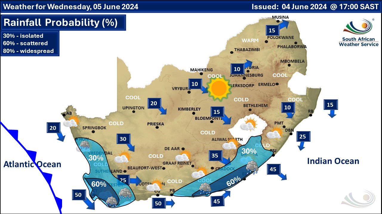
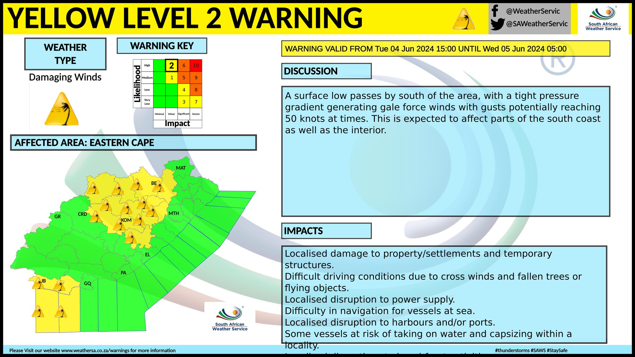
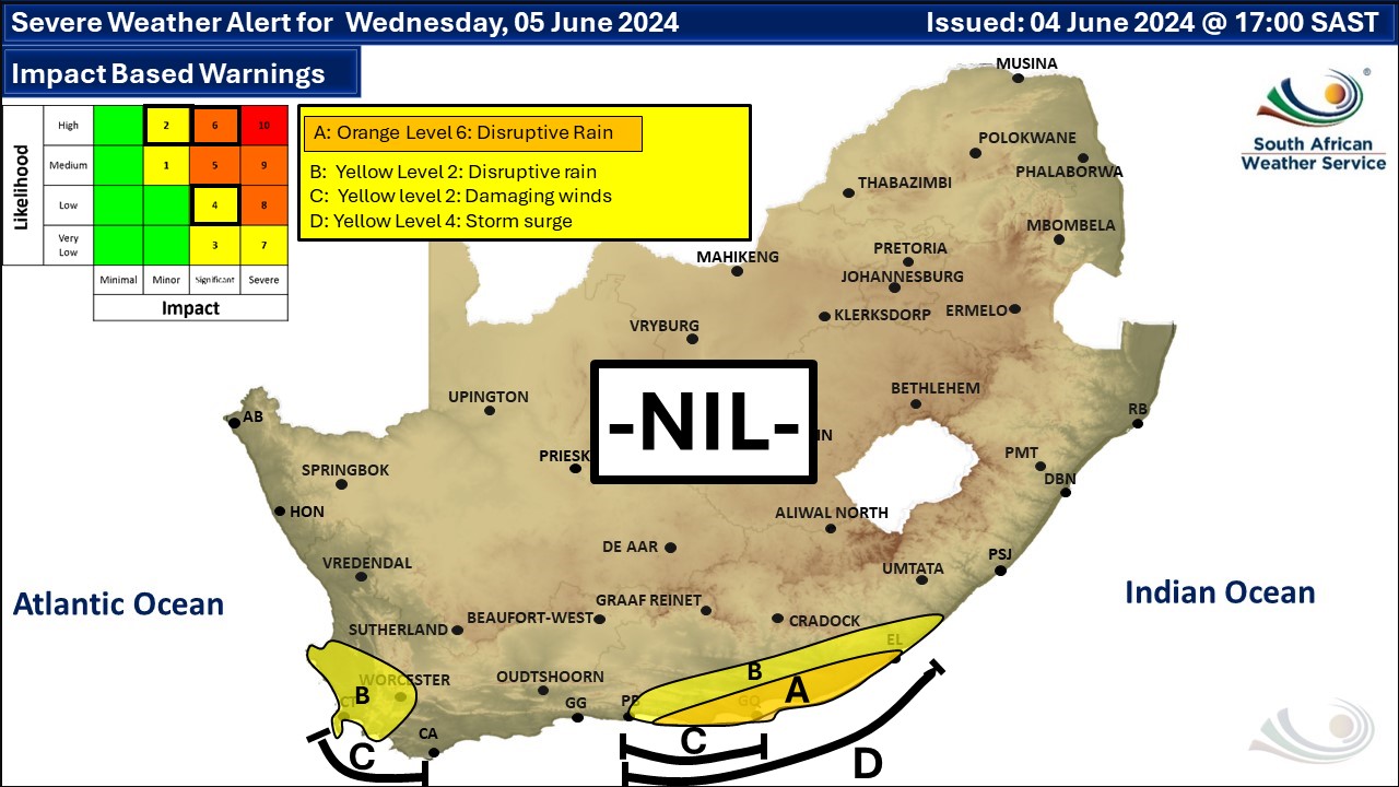
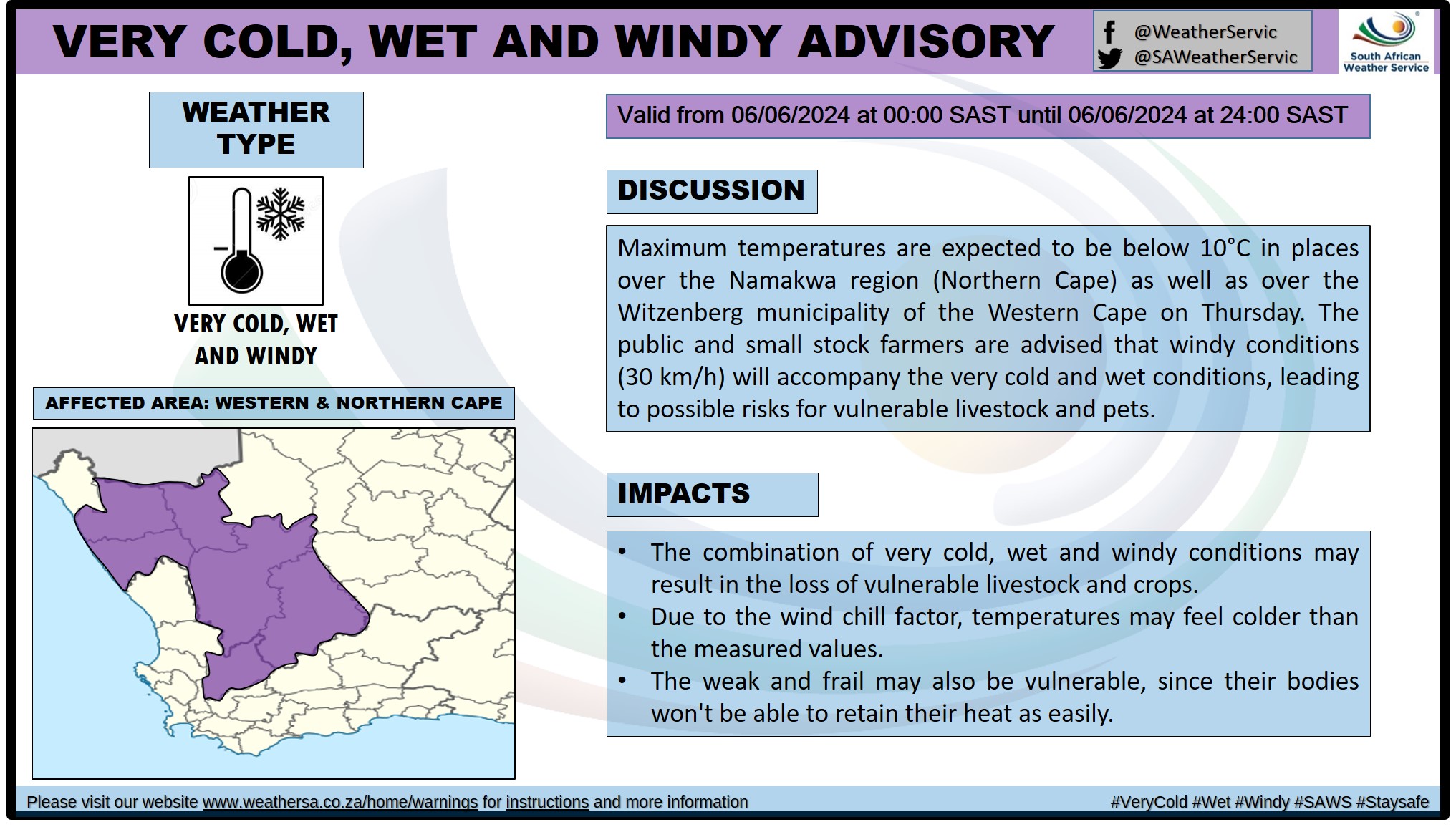
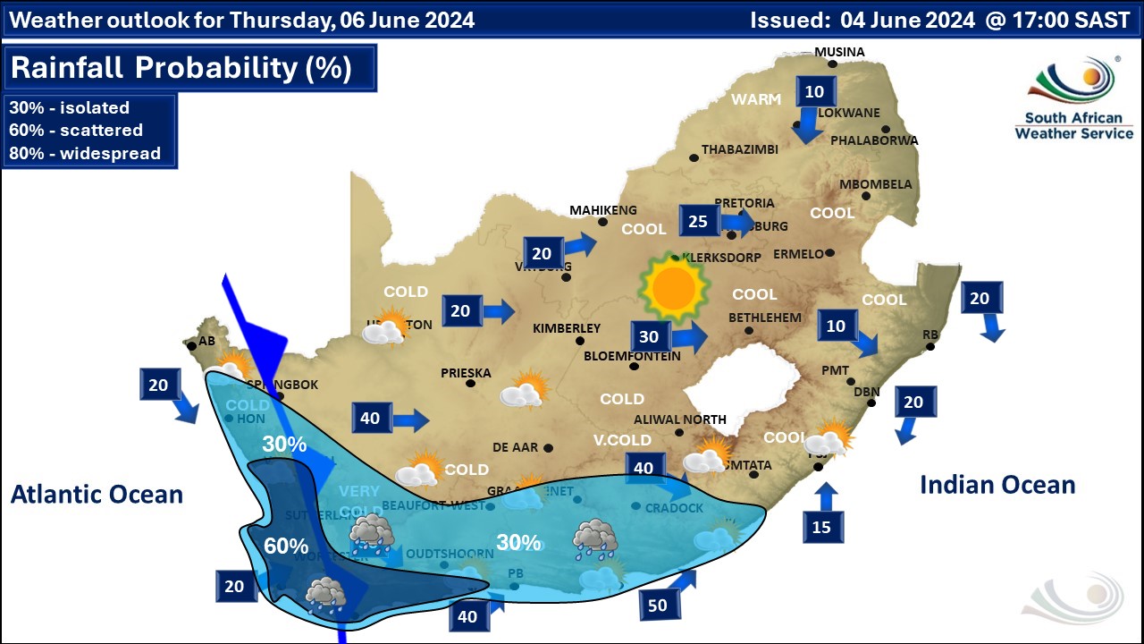
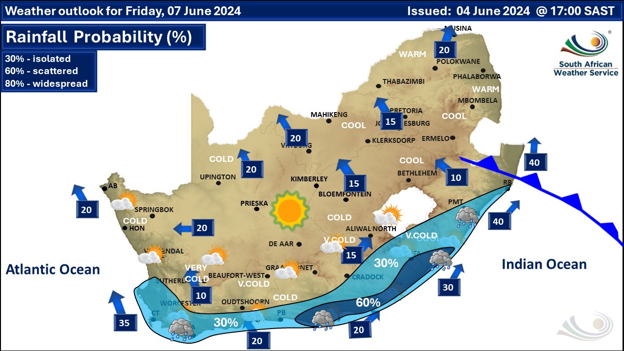
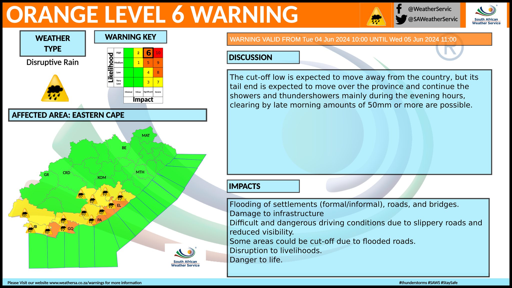
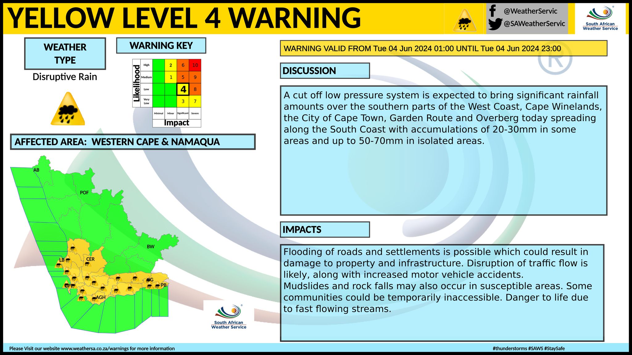
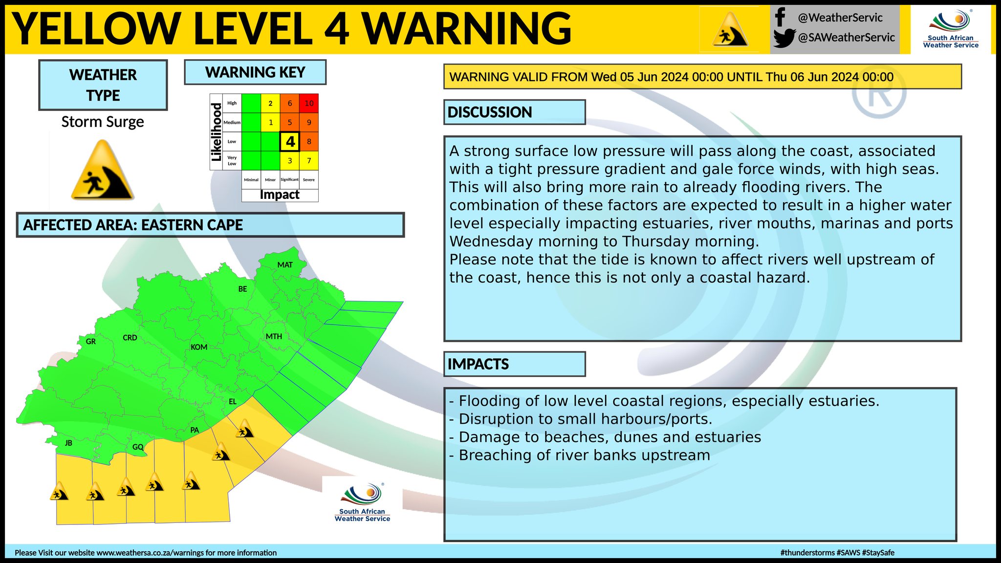
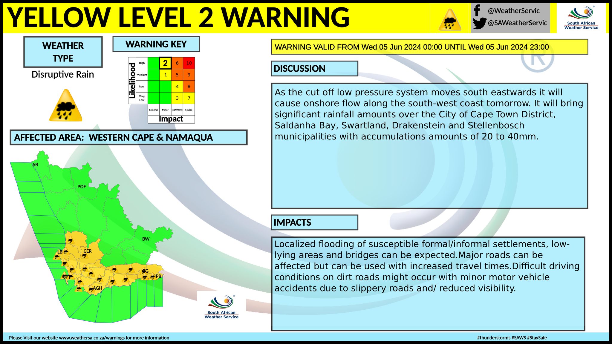
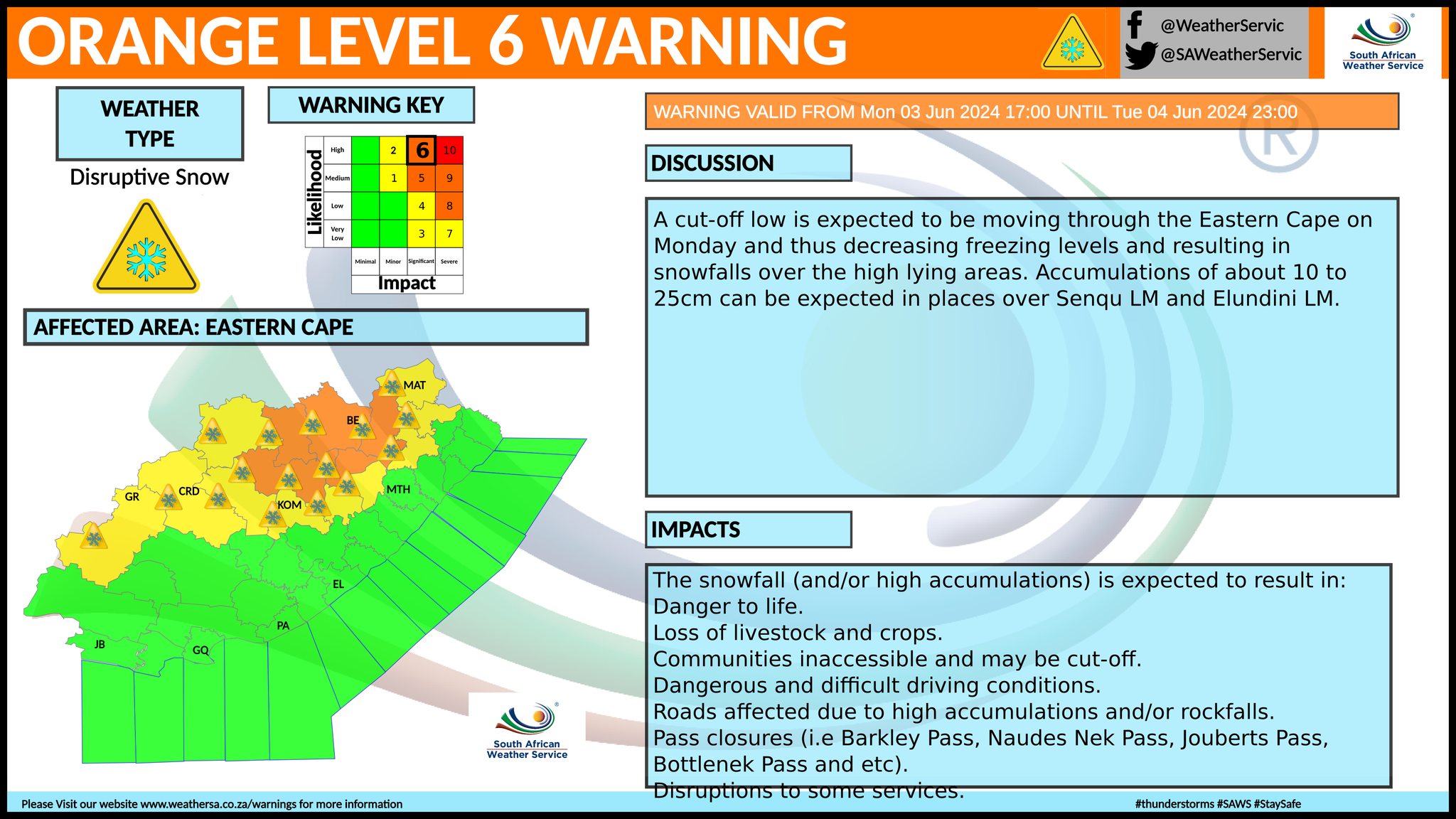
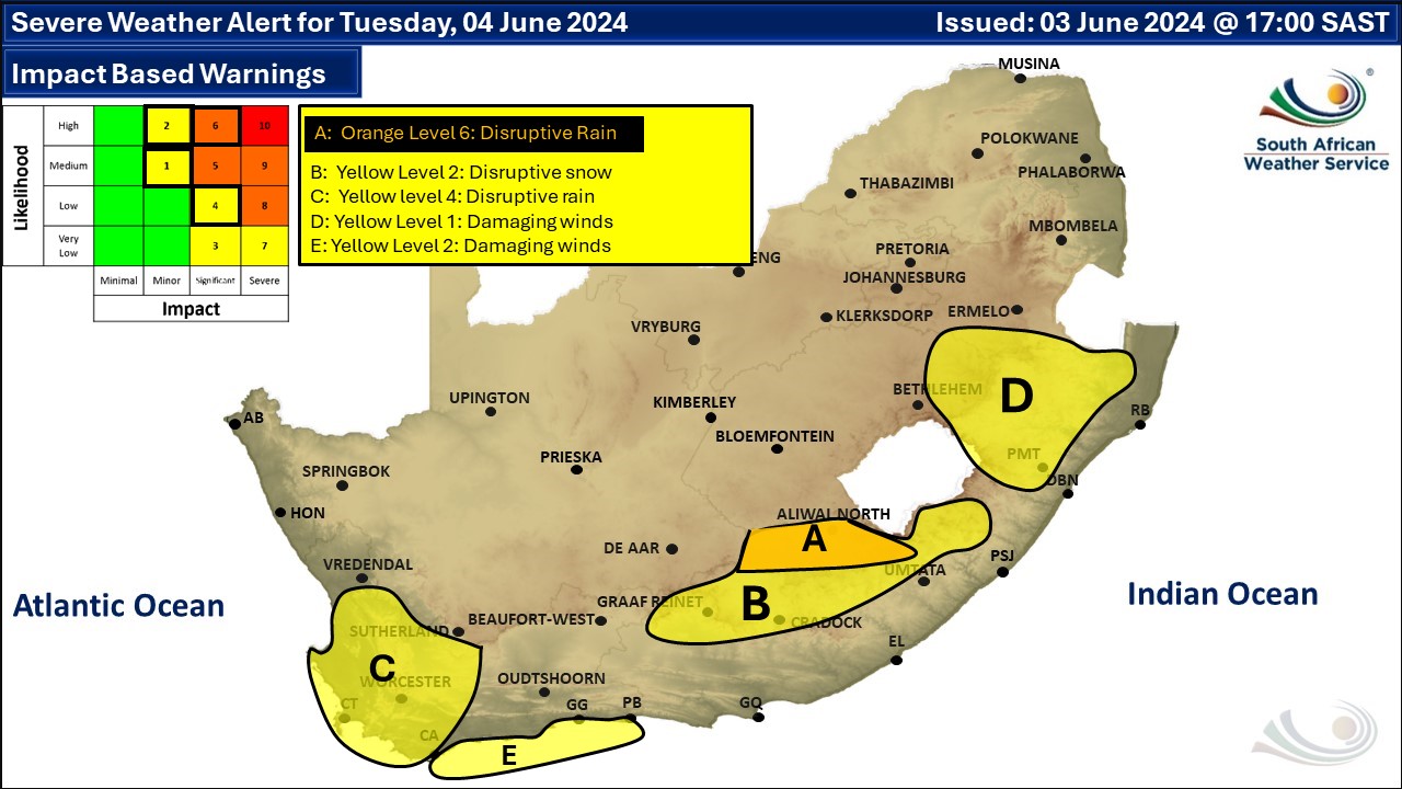
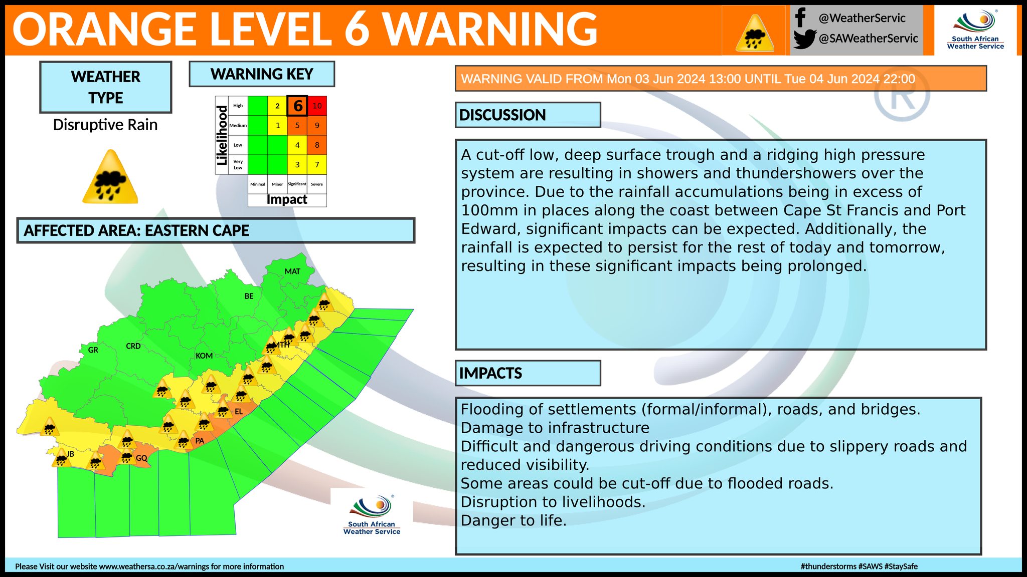
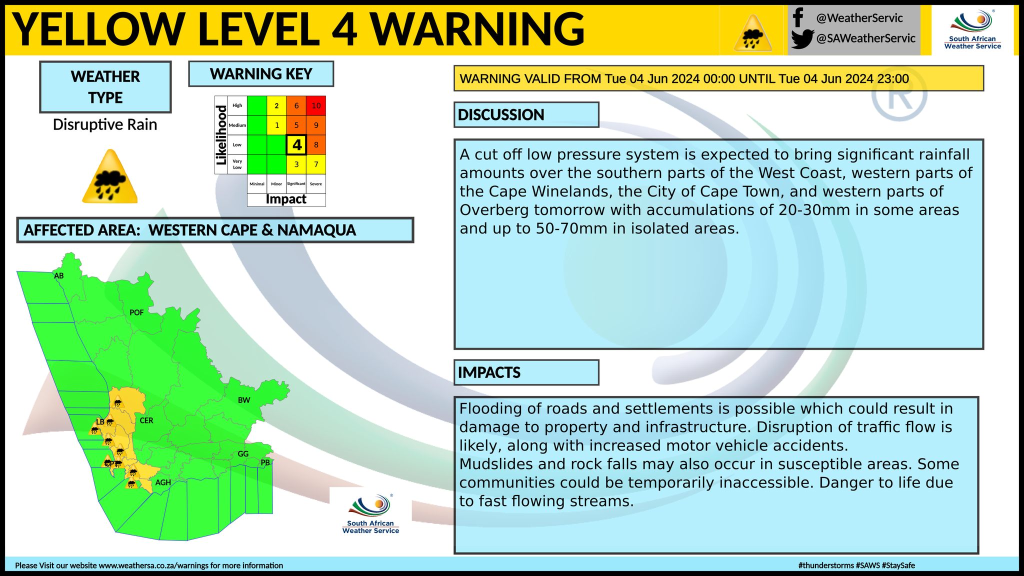
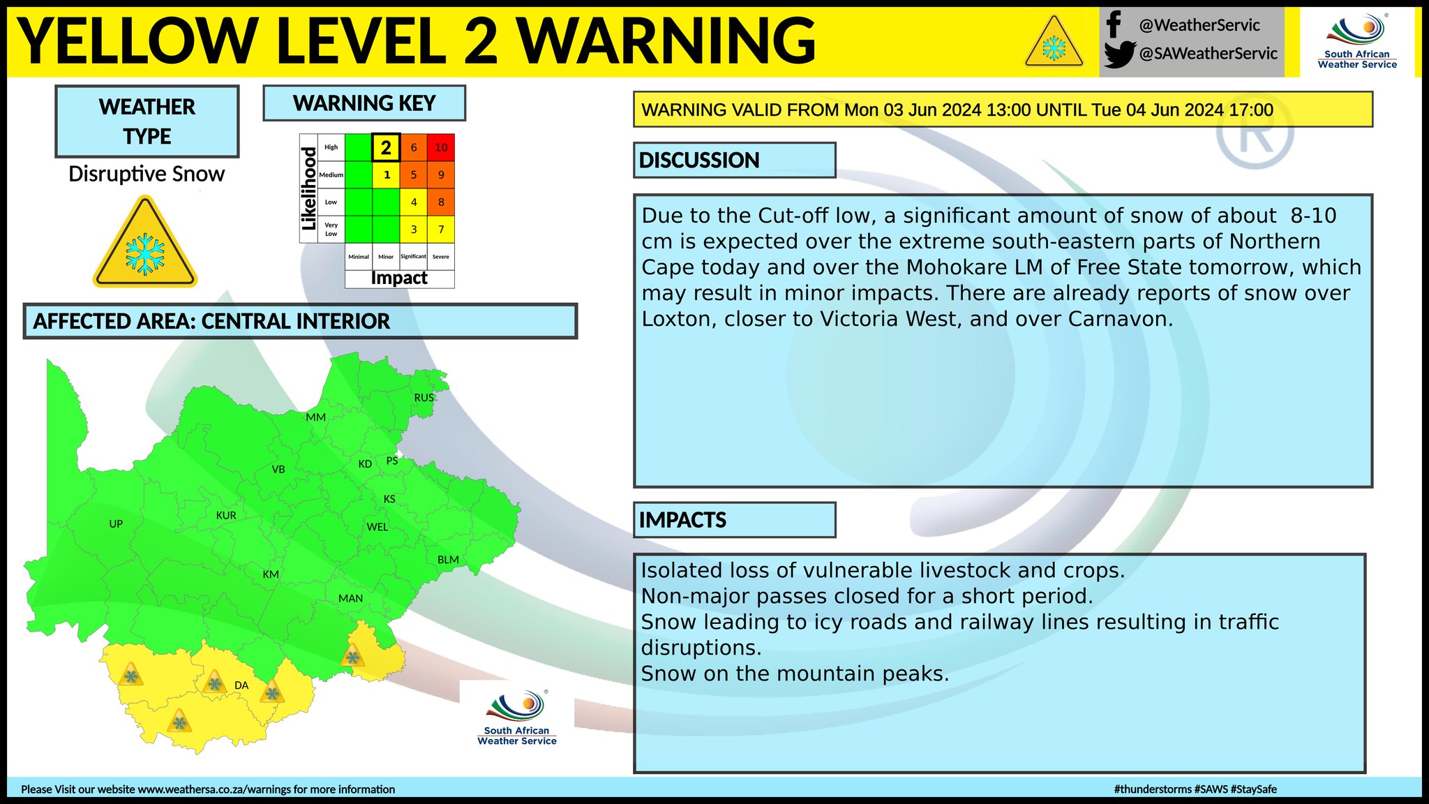
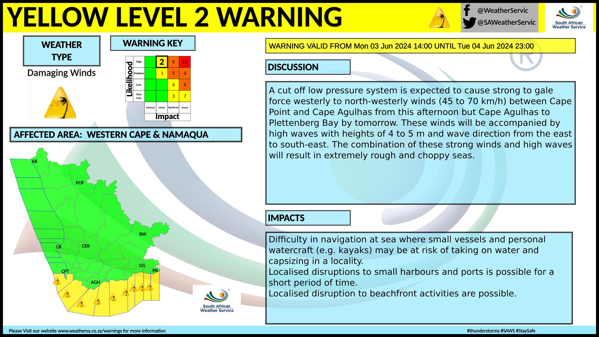
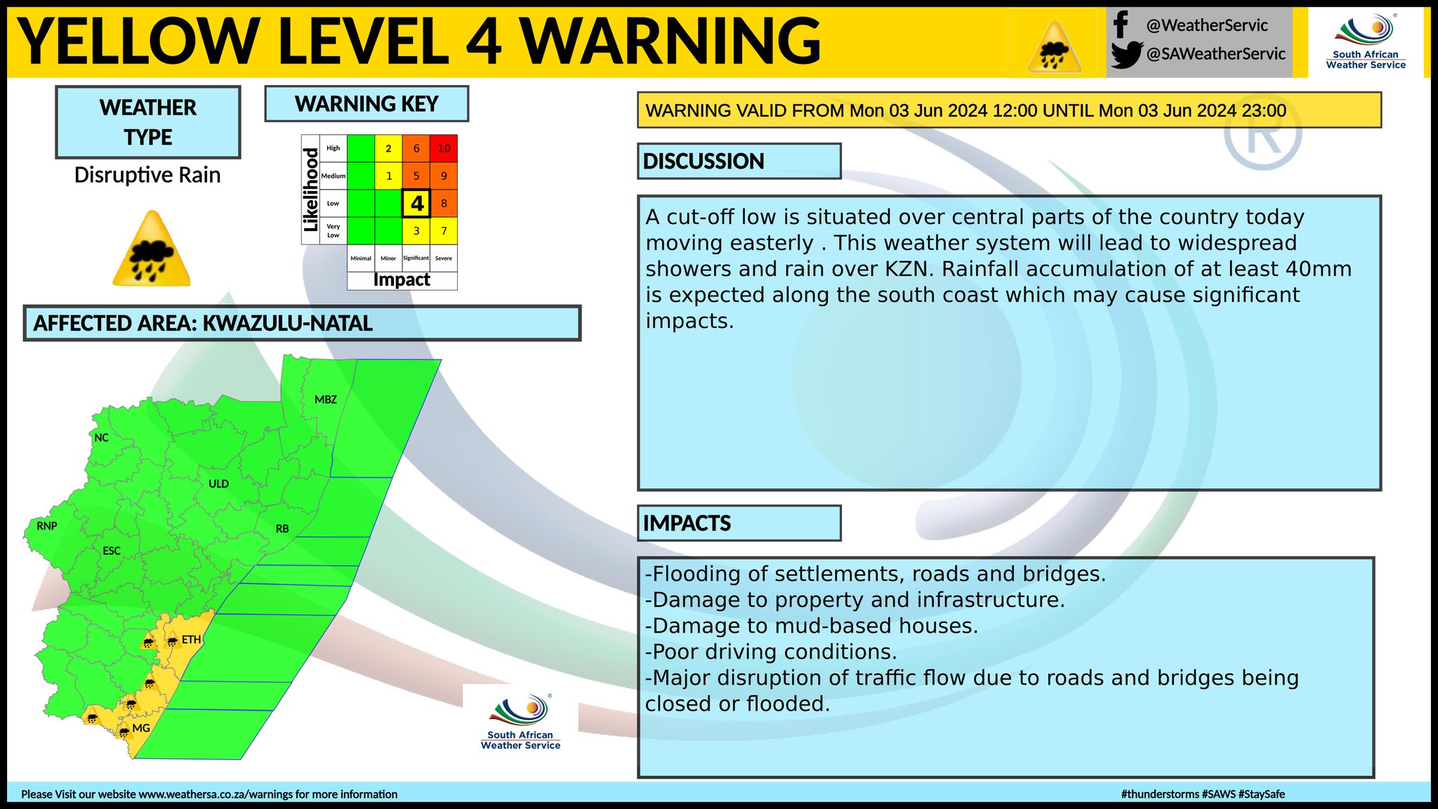
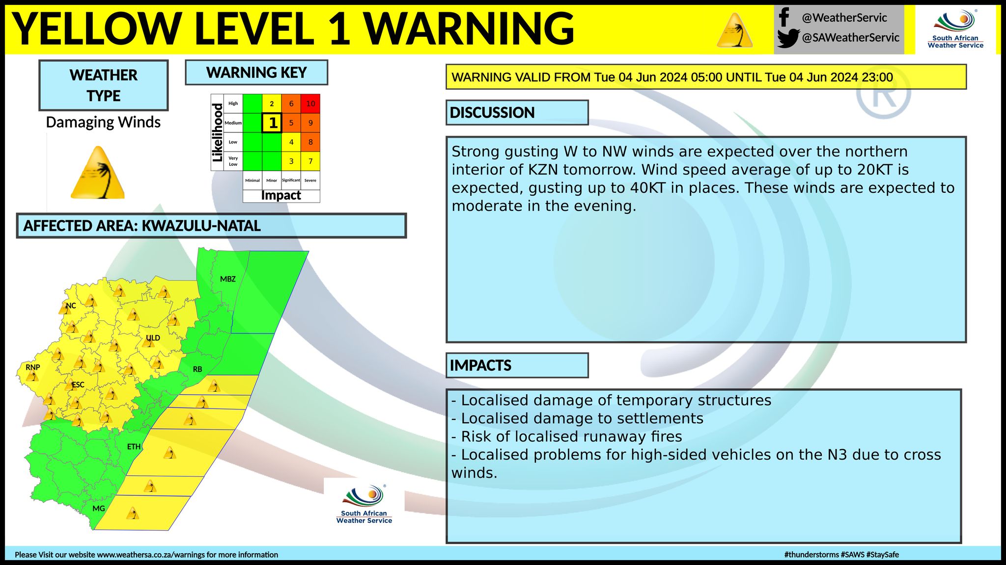
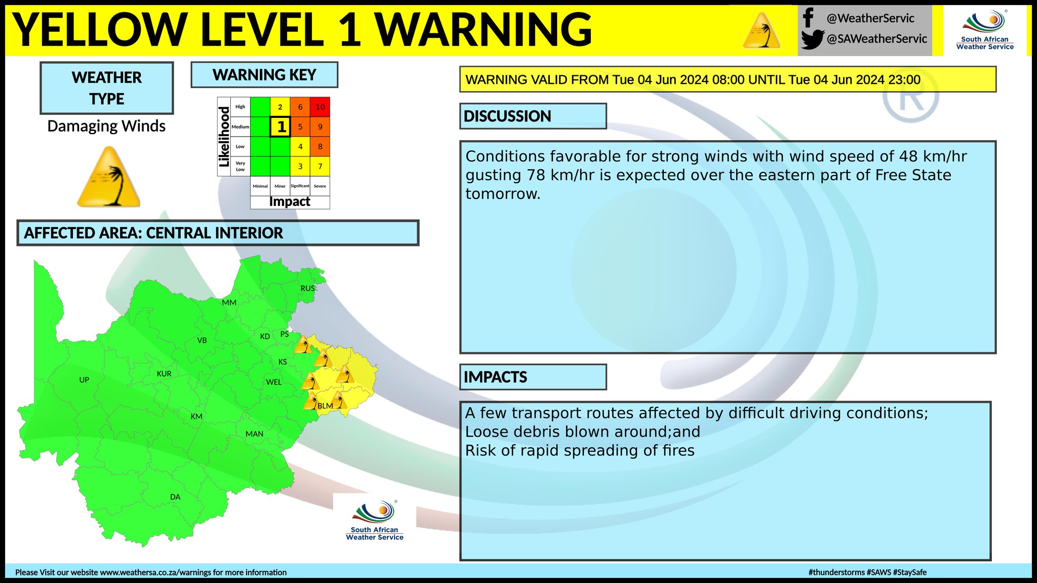
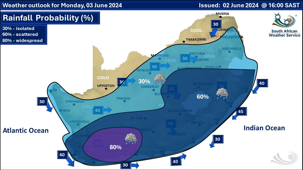
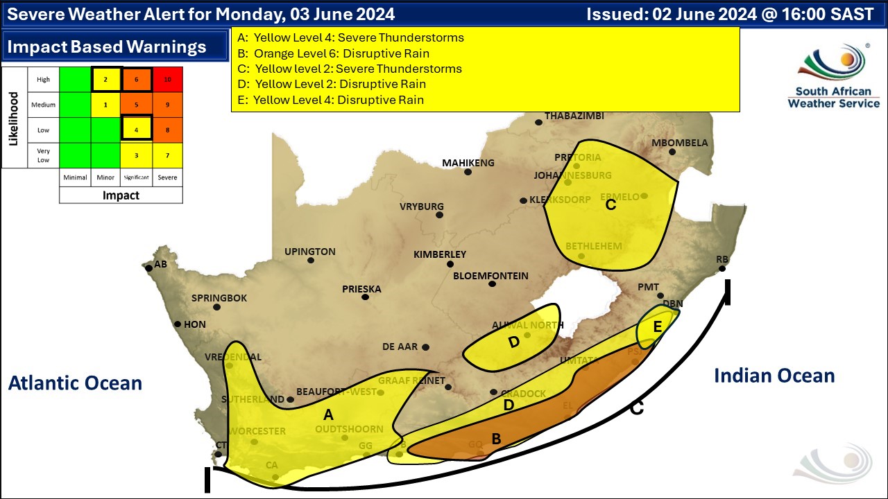
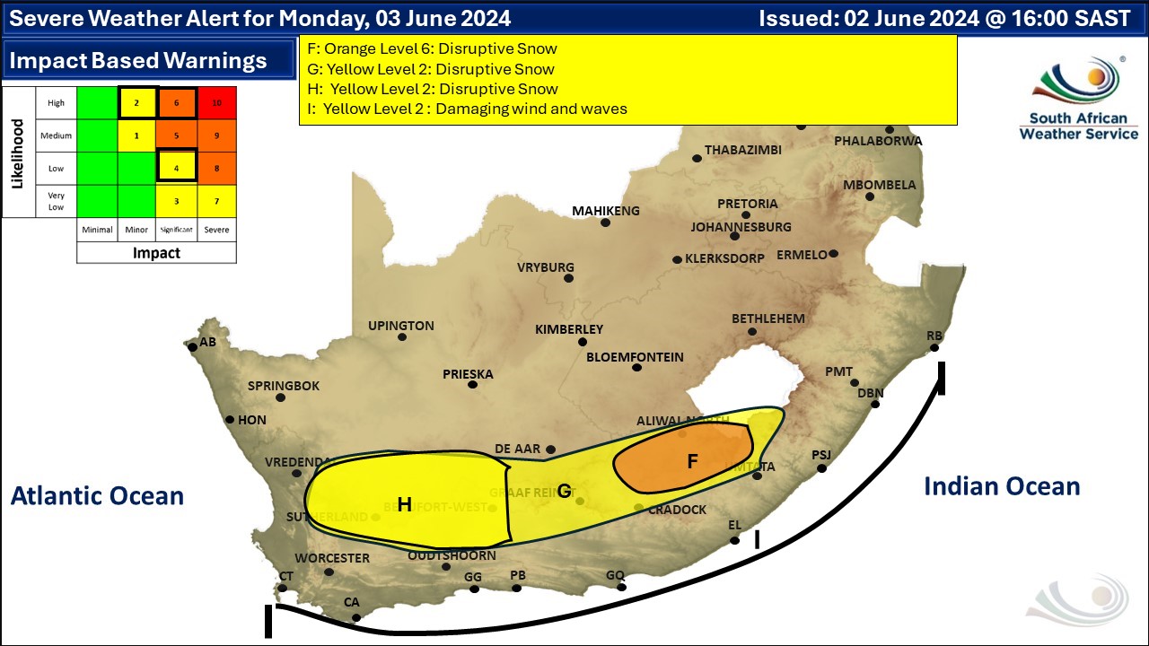
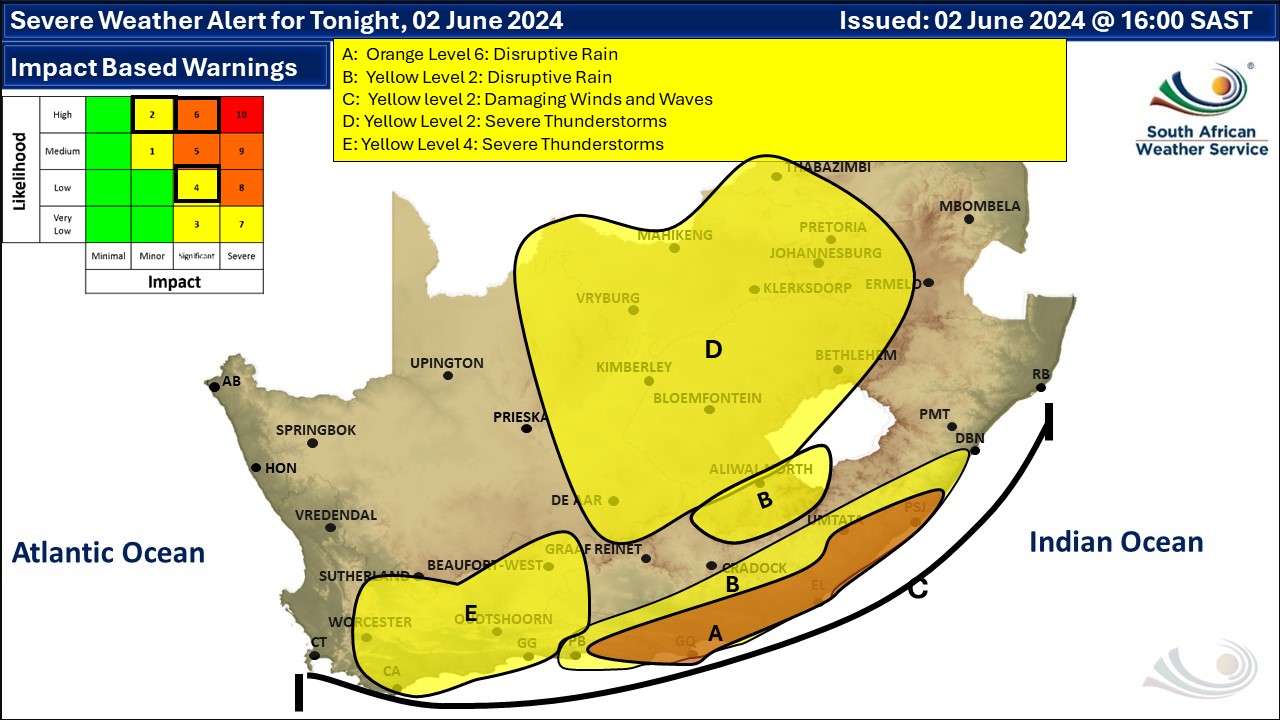
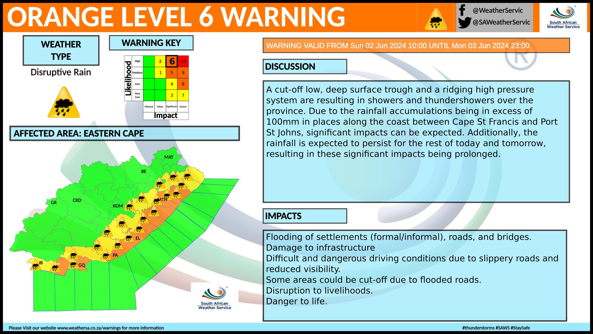
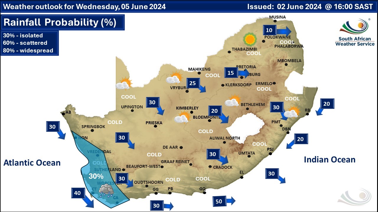
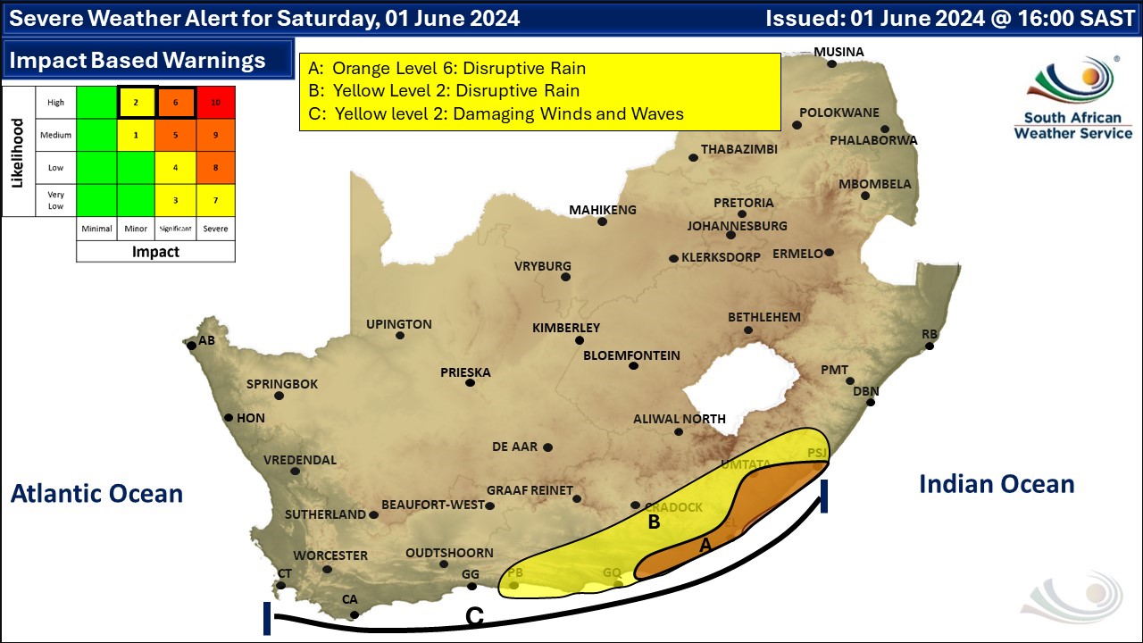
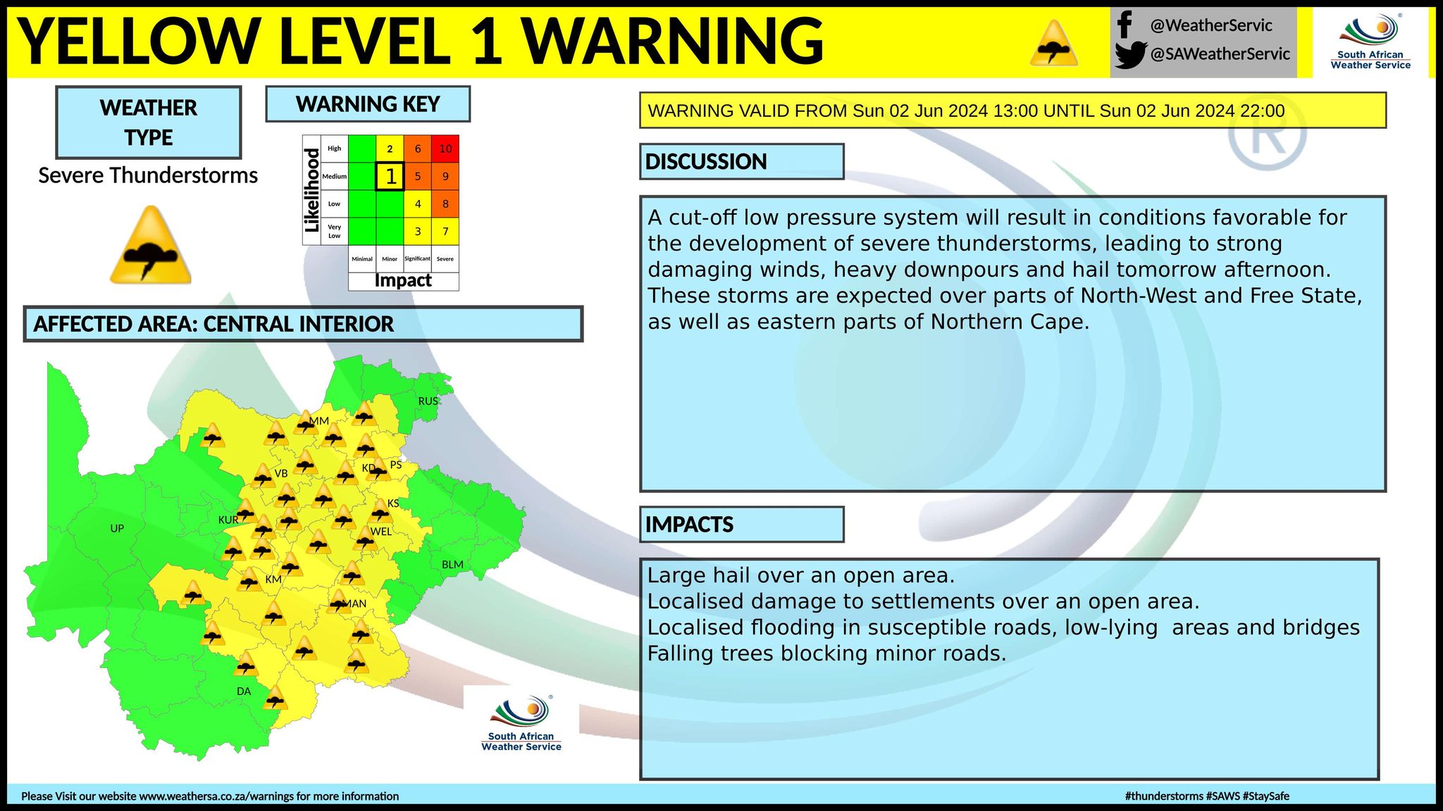
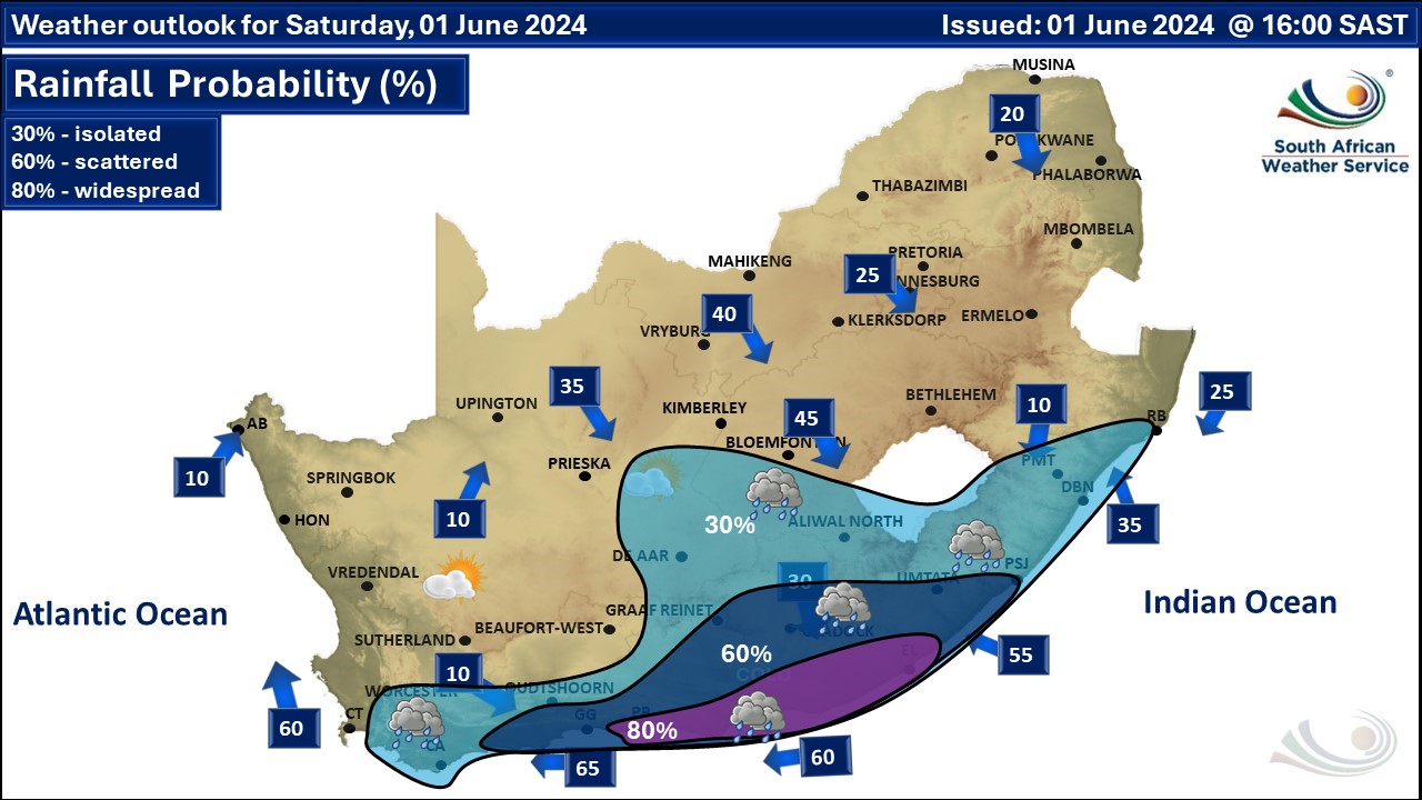
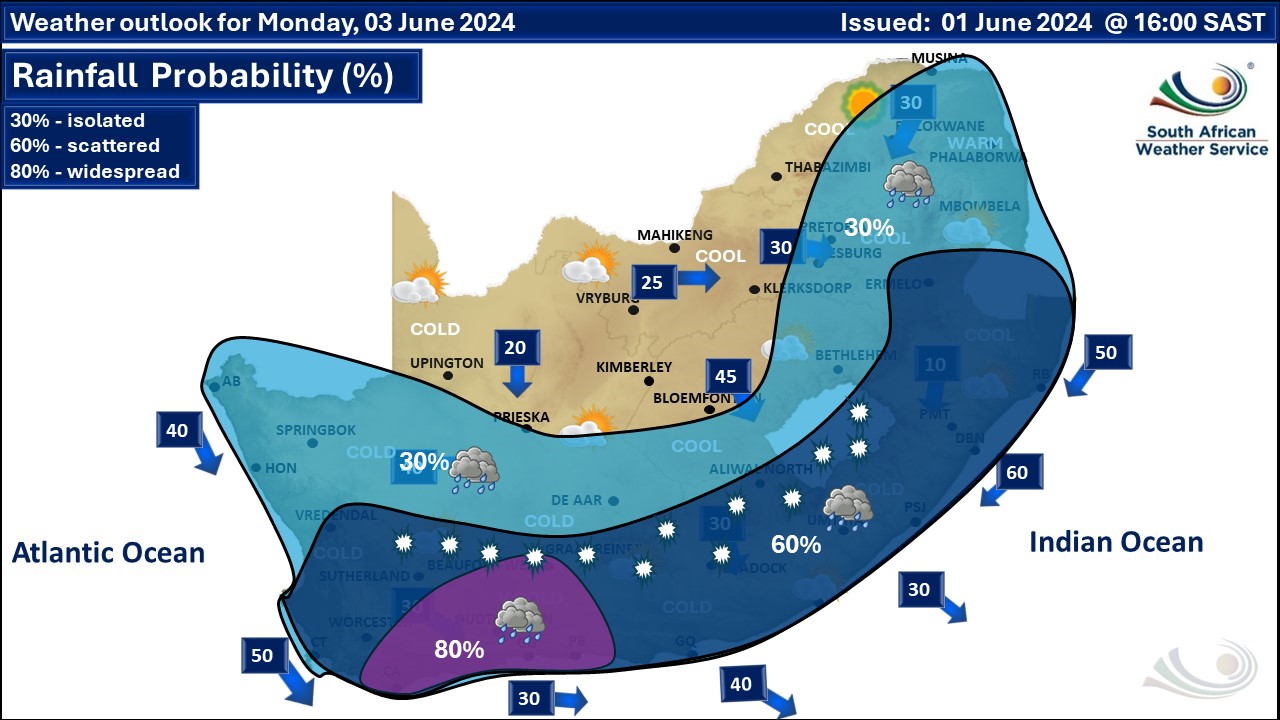
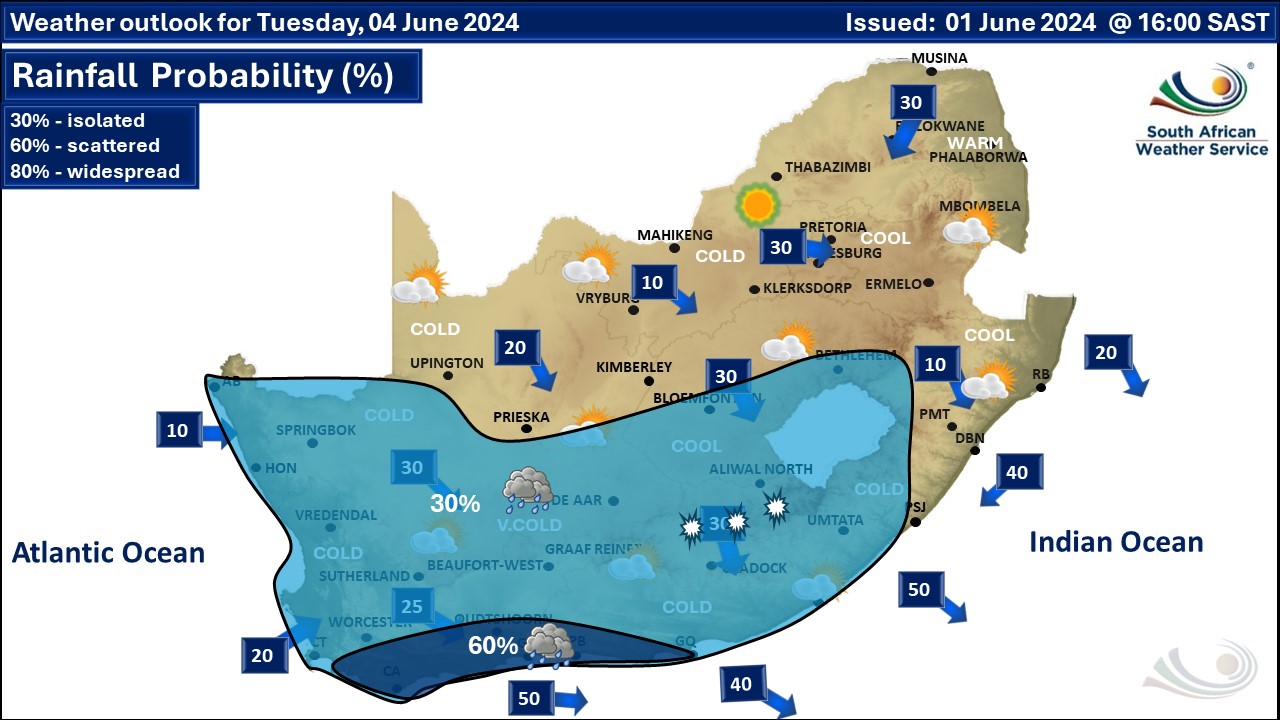
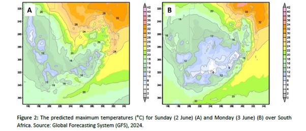
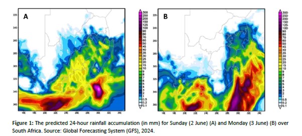
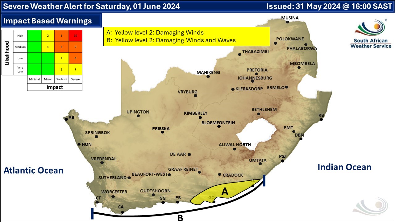
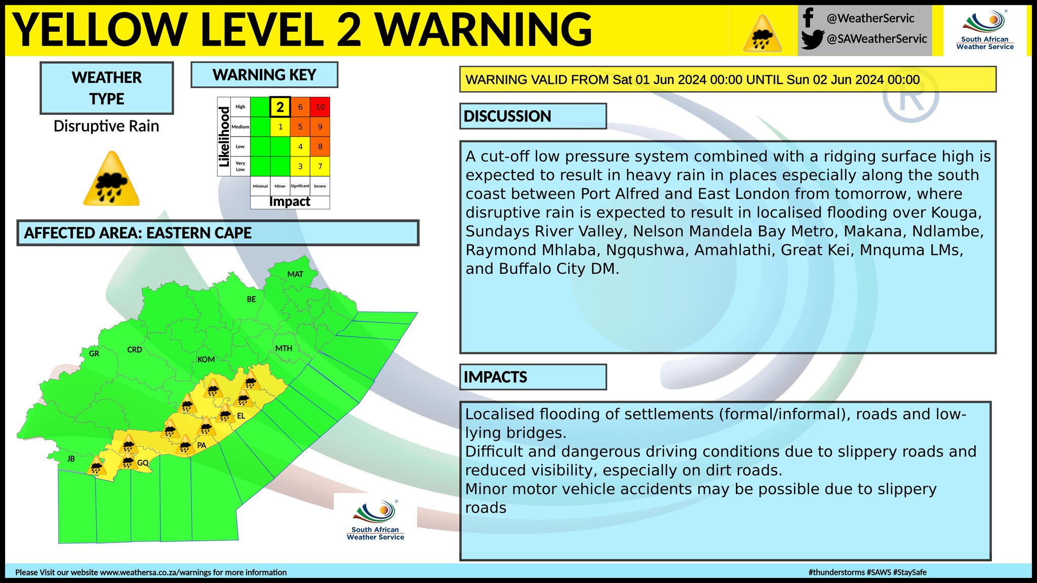
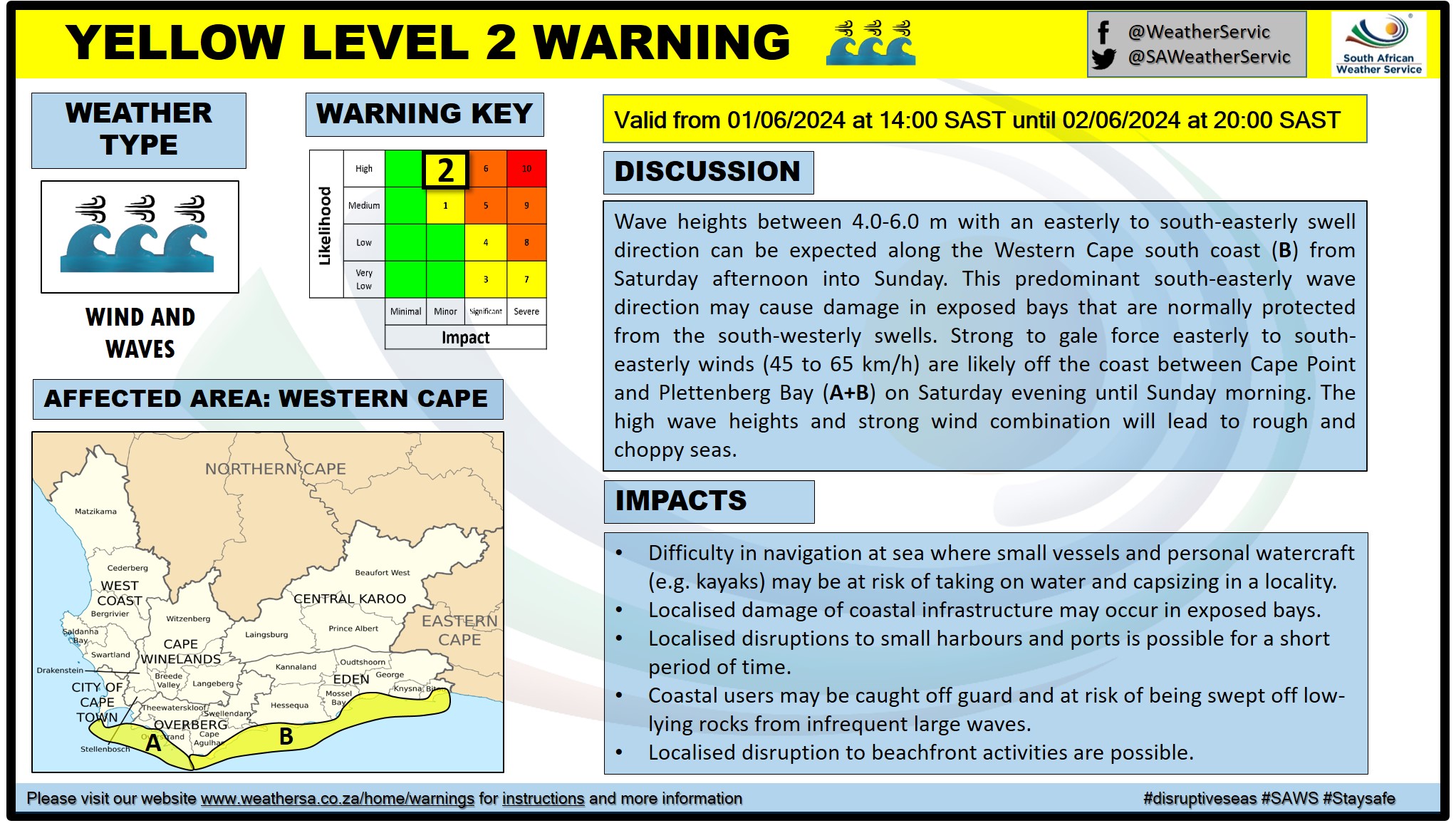
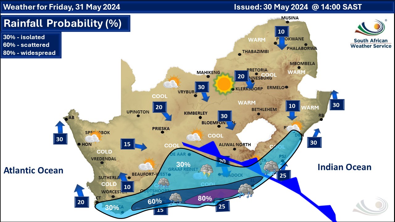
A newer weather forecast can be found here. Winter will arrive abruptly from Thursday 30 May as a cut-off low forms in the region and a series of cold fronts arrive from the west. Strong winds, very cold temperatures, rain and snow are expected through the weekend into the following week. We have also posted a much more detailed SNOW forecast here and this will be updated through the weekend. See the latest snow photos here. According to the South African Weather Service (SAWS), a cut-off low pressure system is expected to result in cold, wet and windy conditions over southern high-lying areas of the Namakwa region of the Northern Cape as well as the central and eastern interior of the Western Cape on Saturday, spreading to the rest of the Northern Cape interior, Eastern Cape interior and Free State as well along Lesotho borders from Sunday to Monday. Showers and rain will develop along the coastal areas of the Eastern Cape from Friday and extend over much of the province from Saturday. Heavy 24-hour rainfall, with accumulations of 50 to 100 mm are possible, particularly in places along the coastal belt, where there will also be strong to gale-force winds, and very rough sea conditions with wave heights of 5,0 to 6,0 meters. Wave heights of 7,0 to 8,0 meters are likely offshore. Strong winds and rough seas are also expected to spread along the south coast of the Western Cape from Saturday afternoon. Marine operations and users, including large and small vessels at sea and beachgoers, should take note of the anticipated deteriorating weather and sea conditions. By Sunday, as the cut-off low moves over the country from the west, it will result in cold temperatures as well as widespread thundershowers across the western, central, and southern parts, then spreading to the eastern parts later in the day (figure 1A). Some of these storms may develop to become severe in places over the central and eastern interior, resulting in large amounts of small hail and strong damaging winds. Rainfall is expected to continue Monday (figure 1B) over the eastern and southern parts of the country. Cold temperatures (12-17°C) are expected across the western and southern parts of the country from Friday onwards, while spreading to the central and eastern parts (including the Free State, North West, Gauteng, Mpumalanga Highveld, and the interior of KwaZulu-Natal) on Monday (figure 2B). Very cold temperatures (maximum temperatures below 10°C), with mountain snowfalls are possible over the northern high ground of the Eastern Cape, the eastern high ground of the Western Cape, the southern high ground of the Northern Cape, parts of the Drakensberg and in Lesotho on Monday. The system is expected to weaken and exit over the country's southern coast on Tuesday, with rainfall still expected over parts of the Western and Eastern Cape. The remainder of the country will see the return of clear weather conditions, but temperatures will remain cold. Warnings issued by SAWS on Tuesday A. Orange Level 6 warning for disruptive rain resulting in flooding of settlements, roads and bridges, some communities temporarily cut off as well as danger to life is expected in places along the coast and adjacent interior of the Eastern Cape in the morning. B. Yellow Level 4 warning for storm surge is expected in places along the coast between Plettenberg Bay and East London. C. Yellow Level 2 warning for disruptive rain resulting in localised flooding of roads and susceptible settlements as well as minor vehicle accidents due to slippery roads and reduced visibility are expected over the south-western parts of the Western Cape and the southern parts of the Eastern Cape in the morning. D. Yellow Level 2 warning for damaging winds leading to difficulty in navigation at sea of small vessels and personal watercraft are expected between Cape Point and Cape Agulhas and between Plettenberg Bay and Algoa Bay. More details about these warnings on the SAWS slides further down the page, as well as more warnings. Regional forecasts from SAWS for Wednesday: 1. GAUTENG Morning frost in places, otherwise fine and cool to cold. The expected UVB sunburn index: High. 2. MPUMALANGA Morning frost in places on the Highveld, otherwise fine and cold to cool but warm in the Lowveld. 3. LIMPOPO Morning frost in places in the south-west, otherwise fine and cool to warm. 4. NORTH-WEST PROVINCE Morning frost in places, otherwise fine and cool. 5. FREE STATE Partly cloudy to cloudy in the south at first with morning fog patches in the east, otherwise fine and cool to cold. 6. NORTHERN CAPE Morning fog patches over the central and southern parts, otherwise fine and cool to cold but partly cloudy to cloudy in the west and south. It will be very cold in the south. The wind along the coast will be moderate to fresh northerly to north-westerly. 7. WESTERN CAPE Cloudy and cold with isolated to scattered showers and rain in the west and south-west. The wind along the coast will be moderate to fresh north-westerly but strong to near-gale in the south-west. It will be fresh westerly along the south coast becoming strong in the afternoon. The expected UVB sunburn index: Low. 8. WESTERN HALF OF THE EASTERN CAPE Cloudy, windy and cold with isolated morning showers and rain but scattered in the south. The wind along the coast will be strong westerly, moderating in the evening. 9. EASTERN HALF OF THE EASTERN CAPE Fine in the extreme east, otherwise cloudy, windy and cold to very cold with scattered morning showers and rain, but isolated in the north where snowfalls are expected. The wind along the coast will be strong north-westerly, moderating along the Wild Coast in the afternoon. 10. KWAZULU-NATAL Fine and cool but warm over the north-eastern parts. The wind along the coast will be moderate north-westerly, becoming north-easterly from the afternoon. The expected UVB sunburn index: High. See the South African Weather Service maps below. This forecast changes regularly and updates will be issued periodically. Please be sure to send photos and videos to us via whatsapp and also tell us where and when they were taken. See below for a link to our whatsapp channel but since the link does not work in the instagram app you will need to send us a whatsapp message and we'll send you a link. Follow our channels
Standard users are welcome to use the standard sharing buttons on this page to share our content. It is NOT acceptable to download or screen grab for reposting. Other media and channels need to send us a request in order to embed or use of our forecasts, maps, as well as images and video from our users that we post (before doing so).
Issued on Tuesday
         Issued on Monday
         Issued on Sunday
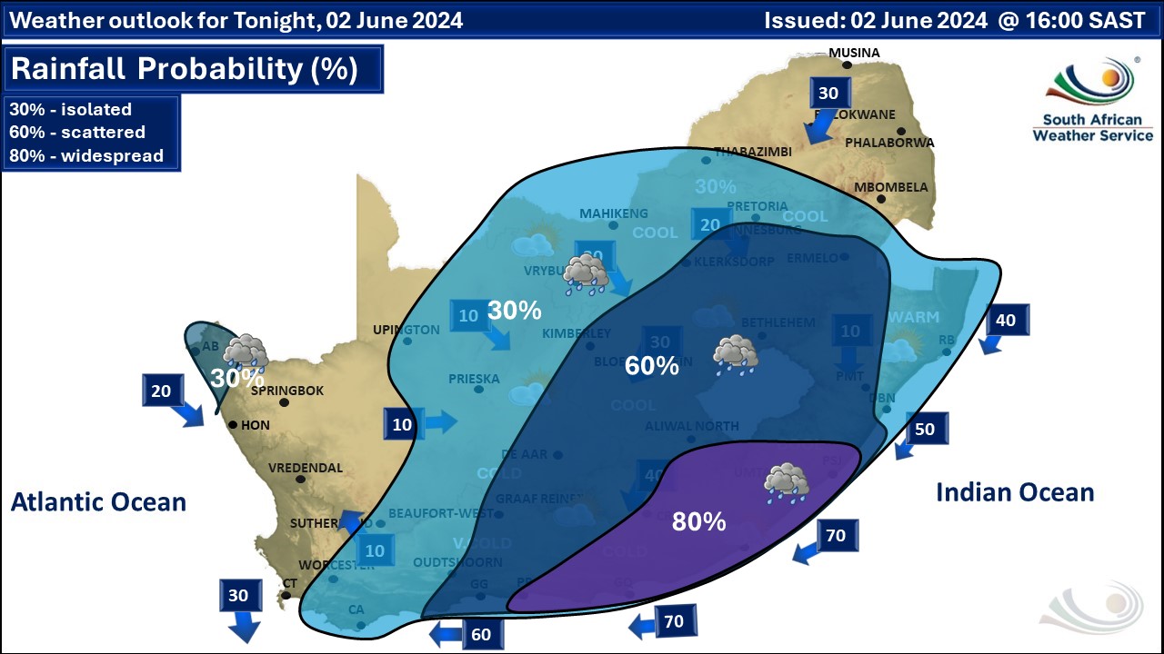         Issued on Saturday
      Issued on Friday
     Issued on Thursday
 |